Climate Change and Ecosystems: A Collective Approach for a Global Crisis

Climate Change is widely perceived as Global Concern #1. But it is only important due to the impacts that it causes. Of these, the apocalyptic loss of biodiversity must be Impact #1. These are massive and complex problems, that will require holistic and collective solutions. All sectors and players need to sign on if we are going to turn it around.
This paper will discuss the general concept of bringing all parties and objectives in to alignment, and specifically, how it relates to agriculture and ecosystems. In the end, it will provide a more detailed discussion on two of the topics – habitat and ecosystem management – as important examples of the process.
What are some key issues affecting climate change and biodiversity?
- Human populations and social concerns are always central to any search for solutions. Social conditions must be not just sustainable, but meaningful and even equitable.
- Environment is a common denominator for most of the top concerns facing global populations.
- In terms of environment, the parts of the system that could have the most impact for the lowest costs and fastest turnaround include agriculture and forestry – aka: natural resources (NR). The more developed and industrial areas will generally be harder and take longer to change.
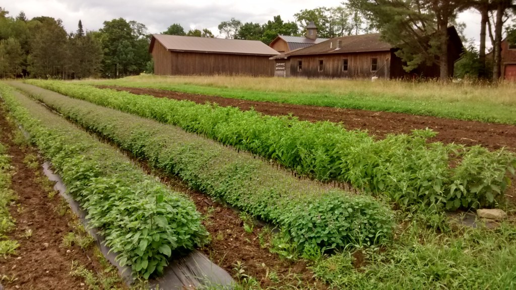
- Why is Agriculture so important? Consider global acreage, energy use, habitat affected, diet and health, labor potential, carbon footprints. Food occupies a place in the middle of everything, for both humans and nature.
- In agriculture, critical modifications could be made very quickly, often with low cost and high benefits, over hundreds of millions of acres. In many cases, simple adjustments to current practices can also increase profitability, even in the short term. Examples include the sophisticated use of cover crops, precision agriculture, and prescribed grazing.
- The conservation movement has been well established now for generations. Like all movements it goes through periods of innovation and stagnation, ups and downs. There is currently a fast-growing trend towards restorative, or ‘regenerative’ agriculture. This is a critical time to act, as methods and motivation are at a high point.
- Government programs and subsidies have largely determined the shape and substance of our agriculture and natural resource management (NRM). Regulation tends to be lenient in the farm sector, and compliance is often voluntary. Redirecting these mega-factors in favor of sustainability should be considered as a core strategy.
- To the extent that some industries may be invested in the status quo of ‘conventional’ agriculture and NRM, they may impede change. This could include: chemicals, energy, heavy machinery, investment, transportation, consulting, bureaucracy, and even health care and academia.
- On the positive side, the financial sector is rapidly addressing Environmental concerns (ESG) with increasing clarity and impact. ‘Methods and metrics’ are evolving quickly – can this also happen in the public sector?
Why focus on Agriculture? There are many other strategies, such as: Conversion to renewable energy; IT advances, including AI and remote access; changing consumption patterns; Recycling and conservation. All are important, but only agriculture offers so many fast and far-reaching options. What are some of the big issues and possibilities in ‘Ag’?
Major issues related to Agriculture
- Area-wide management and planning. Must address current priorities, below:
- Biodiversity. Rapid widespread decline and extinction, related to:
- Habitat loss – Development, abuse, fragmentation and dysfunction – including the rampant and wholesale destruction of tropical ecosystems as a top priority.
- Climate change – exceeding worst predictions – impacting environments, economy.
- Fire control and planning. New, integrated, pro-active approach is needed.
- Soil erosion – due to wind, water; off-site transport causes pollution.
- Water quality, and water supplies; Dams and diversions. Flood control. Ice melt.
- Wildlife exclusion practiced on farms, and other operational impacts to ecological function.
- Agriculture subsidies and contracts to ‘conventional’ farm operations. And possible alternatives.
- Global vs. Local food systems. Shifting the balance.
- Social impacts, related to all of the above, and more. Employment opportunities. Population displacement, and resettlement.
Discussion – Realignment, with a focus on Agriculture
One major problem is that strategic objectives have not been set for many criteria that are crucial to overall sustainability. In addition, there may be no system of shared accountability or oversite in place to effectively meet the objectives. The following expands on some of the key areas where clear objectives – and alignment based on those objectives – would be crucial.
Area-wide perspective. Agencies may conduct intensive environmental review, but overwhelmingly these reviews are on a private, case-by-case basis, limited to one farm or factory operation. Even where an area-wide scope is required, there may be a lack of information or objectives that is readily available to planners. In most cases, it is not because the information doesn’t exist, but rather because it has not been assembled in a usable format. Recommendation: Area-wide reviews, data and analysis could be pre-compiled into a format that is readily available and meaningful to a wide range of planners. This product, a strategic summation of local objectives, could be coordinated by a diverse group, including conservation coalitions and partnerships. One example of a collaborative, statewide presentation tool is by PA Conservation Explorer, at conservationexplorer.dcnr.pa.gov/.
Thousands of natural resource conservation plans are undergoing assessment at any given time, impacting a vast acreage in the US. Having ready access to better area-wide summaries could have a major impact on the effectiveness of those plans.
Habitat conservation, targets – Globally, the highest priority by far is to stop the rampant destruction of global ecosystems, particularly deforestration in tropical regions such as the Amazon, Sub-Saharan Africa, and Southeast Asia.
In the U.S., goals must be set for habitat conservation, based on both existing and potential habitat maps on an area-wide (100% land area) basis. Habitats cannot be preserved unless clear targets have been set and accurate habitat maps, including future build-out’ maps, are readily available to reviewers. In considering long term objectives, planners will have to consider existing conditions, historical records, and potential habitats. Maps and records must be available for each case. – See further discussion below.
Biodiversity – Targets must be established for species of concern for each watershed or region – based on historical and existing records, including both actual sitings and probable or potential presence, for the entire area. Potential presence can be modeled and inferred based on: soil types (and associated eco-zones), habitat, and many other criteria. Practically speaking, species targets may be established based on their correlation to associated habitat types (See Vermont example). The basics of landscape ecology – planning and design – must be included in this process. An early emphasis on riparian zones is recognized as a top priority, in view of past abuses, importance and feasibility.
Mapping ecological status – It is not enough to assign a certain land use or land cover id to a given land unit. For any given land use (ie. Cattle grazing), the ecological effects can vary from highly supportive to highly destructive. A consistent methodology is needed to assess the ecological status of all land units, which could then be used along with other recorded data (GAP’s, BMP’s, etc.) to map current conditions for farm, forestry, or industrial operations. These maps can be used to help create area-wide assessments, and will facilitate planning and implementation for habitats and species of concern. Land units that practice intensive wildlife exclusion, such as many horticultural operations, are prime opportunities for conversion to sustainable methods.
Soil erosion, and transport off-site. Soil erosion is carefully quantified for each field unit in the planning process, using very sophisticated tools that have evolved over generations of soil scientists. In most cases, however, the calculation is for in-place movement only, and does not quantify off-site transport, which is needed for any area-wide assessment. Such off-site migration can be modeled using existing tools and data. For examples, see ongoing regional water quality programs, such as Chesapeake Bay, Lake Erie, Lake Champlain. Access to accurate input data may be a major concern for such modeling.
Soil erosion – sustainable threshold. A threshold for soil erosion is routinely calculated for all planned farm units, and many other applications. However, the threshold value itself may reflect an historical convention based on perceived feasibility, rather than on a sustainable amount of loss – it may have little or no relation to the actual rate of re-generation for any given soil type. A value reflecting sustainability should be more widely considered and used for planning and assessment purposes, such as area-wide impacts and off-site migration, as mentioned above.
Carbon sequestration: Management practices and land uses should be assessed in terms of their ability to sequester or conserve carbon, which is now recognized as a critical priority for Climate Change issues world-wide. Notably, the ongoing maintenance of living ground cover is a critical factor in CO2 levels and sequestration. It is also a top priority in terms of erosion control and overall soil health. Global imaging data, such as NDVI or NRG, can be employed to facilitate this assessment over any size area. That type of information (along with LIDAR, high res imagery, and other modern tools) could be facilitated and factored in to assessment at all levels, from small farms to whole regions.
Crop genetic resources – seed saving: The conservation community should set criteria for conserving the genetic resources of crop plants as well as other species (native plants, animals, etc.). What percent of historical varieties are we prepared to lose, and which ones? On the current course, almost all varieties that were developed in the past 20 plus millenia will soon be extinct, as commercial varieties replace them. This would be a tremendous loss to the industry, and to humanity as a whole. A national program for the purpose of growing out and preserving the surviving seed collections should be implemented on an emergency basis.
Strategic Plans: Agencies and organizations that have discontinued strategic planning in recent decades should reconsider the process, as a way to coordinate and inform their workers and also a wider community of partners and the public. If resources are not available for such planning, then a more streamlined process of outlining OKR – objectives and key results – should be considered. It must be a transparent and collective process, emphasizing partnerships and a shared sense of accountability.
Water Supply, Dams and Diversions: Dams are increasingly recognized as damaging to ecosystems in general. But in some parts of the world today, thousands of new dams are being planned. In the U.S., many dams are overdue for maintenance, repair, or decommissioning, and will be up for consideration as a part of the planned massive investments in infrastructure. De-commissioning offers a vast opportunity for the revival of impacted eco-systems and hydrology, along with many other benefits. However, it would require very intensive, area-wide planning in order to manage the economic and environmental impacts. For example, can water that was stored in dams be re-directed to wetlands or to aquifers, such as the depleted Ogallala in the Midwest? Can water customers modify practices to use less water? How much subsidy to water users is justified? Is there an urgent need to re-balance human vs. ecosystem benefits? Can other sources of energy, such as wind or solar, replace hydroelectric? And finally, how can the current flood control benefits be maintained if dams are decommissioned? All of these considerations will require accurate regional data, maps and funding for assessment.
Ice Melt: The rapid decline in fresh water stored as ice and snow presents a problem similar to that of dams, but on a much grander scale. About 70% of the earth’s fresh water is/was stored in solid ice form, and it is melting off very fast. The dangers this presents for countries like India is catastrophic. (Sea water rise is of course another dire consequence of ice melt). And will it be possible to capture, store, and deliver this new melt water to those who depend on it, in order to avoid catastrophic losses? Finally, how do we handle the newly exposed surface areas? Millions of acres of frozen terrain must develop new vegetation to prevent erosion. How can those ecosystems be optimized, and who is working on it?
Fire Control and Planning: Wildfire management is under massive strain, worldwide. Fire issues are related to biodiversity, climate, hydrology, habitat – in short, it is related to all other landscape functions, and will benefit from a regional, area-wide approach. The maintenance of contiguous riparian and wetland habitats, the expanded use of native plants and cover crops, and soil health in general will all play a part in fire outcomes.
Drones and other sensors: New forms of imagery and sensory inputs are rapidly changing the whole process of farming, land management and oversight. However, some public sector agencies have been slow to adopt such technologies. This could be accelerated with concerted efforts to set up data acquisition through outside contractors, and train staff in its use. Resources spent on travel can be reduced, while data access and accuracy can be vastly improved. Many other types of sensor data can be acquired remotely and digitally (water use, fertilizer, chemical application, etc). Process and procedures to capitalize on this technology should be aggressively developed in the public sector. Programs like universal soil testing (below) will augment these developments.
Alternatives to contracts and subsidies: The U.S. provides hundreds of billions in direct payments to individual operators, in support of various objectives and practices. The processing of such casework is extremely time consuming, even for small operations. For the sake of efficiency, these subsidies can favor large scale, conventional and industrial operators, versus small scale, sustainable, diverse, etc. There may be alternatives to such direct, case-by-case subsidies that are overall more cost effective, benefit a wider community, and produce different results. See an expanded discussion below, and the example of a universal soil testing program.
Social Concerns: Human settlement patterns and environmental conditions are very closely related. Humans have, in general, been removed from rural areas, in favor of industrial farm/forestry operations that require little human labor. However, it is not clear what to do with those who have been displaced. Is it possible that resettlement back to rural areas and reconnection of people with farming and natural resources is one solution to both social and environmental problems? The conversion of Latin America from traditional peasant farming to industrial operations (cattle, bananas, coffee, etc) and the subsequent dislocation and social collapse is well known. But the future of farmland in the U.S., which is now poised to shift from family to corporate ownership in the very near future, is less so. There is a huge opportunity for resettlement of Americans back to rural areas, which may also resolve the critical labor and housing crises in many cities. But without careful planning, we could easily find ourselves in the same situation as Latin Americans, another banana republic with millions looking for some better place to live.
Focus 1: Universal vs. Case-by-case strategies:
In the discussion above, alternatives to the current reliance on individual subsidies are suggested. This is partly due to the high administrative overhead required for public management of farm contracts and subsidies. As a result, these benefits tend to be directed towards the largest, and in general, most ‘conventional’ operators. It can result in landscapes dominated by typical industrial operations, such as Corn/soybeans, small grains, CAFO’s and feedlots, while precluding operations that are smaller, distinctive, biodiverse, labor-intensive, etc. One alternative may be to redistribute the public resources towards more universal and streamlined services that do not require so much contract overhead. Such services might include:
- Infrastructure development, in general.
- Transportation – Roads, rail, aviation,
- IT, communications, grid, satellites, …
- Water supply and water quality management, area wide – dams, canals, ground-water monitoring, allocations…
- Market development, advertising, representation
- Planning, coordination, communication
- Consultation, on-site inspection, soil testing (see example below), conservation planning assistance
- Research, (ARS…).
- Food system development, from local to international (AMS….)
- Food safety and certification, oversight, assistance (FDA, APHIS….)
- Training – of operators, service providers, (Ag Extension…..). Education, at all age levels
- Social support services (RD – Rural Development….) – rebuilding farm communities.
- Regulation – establishing and enforcing standards, by both public and private sectors.
All of the above services are already offered to some extent. But cost-benefit studies may show that such universal services and programs can be much more efficient, in relation to the outcomes. And, that those outcomes may be very different.
Example: Universal Soil testing: One example of an alternative to direct subsidies may be low cost, universal services, such as soil testing. All farm operations require soil testing, but there are various drawbacks: cost, consistency, accuracy, etc. Quality control is an issue. This may be one area where a universal program/service coordinated by public and academic experts, rather than farm-specific contracts, could yield substantial benefits at relatively low overall cost. Agencies could coordinate the testing for participating producers at free or reduced rates, while avoiding the high overhead of managing complex federal contracts for each producer.

Focus 2: Area-wide Planning for habitats and species
On a national level, an effective strategy for conserving biodiversity has not been developed. The basic guidelines for ecosystem planning have not been defined, in consistent and actionable terms. Underlying assumptions and methods have not been established.
The following is a quick outline that illustrates what these guidelines might address. It presents a step-wise approach to area-wide planning for any given region.
- Area-wide (100% land area covered) habitat maps are prepared . Habitat maps were developed for ecosystem planning, nationwide, under the federal Gap Analysis Program in the 1990’s. Many advances in the data, science and application have taken place since that time. Habitat maps can be based on many factors, including field observation, remote sensing, land use and cover, topography, and, soils. The science is mature, but resolution and accuracy may vary widely by region.
- Species of concern are identified and mapped, or modeled based on other factors. Species distribution can be based on actual sitings, habitat maps, models, and other variables. Distributions have been mapped nationwide, but the accuracy, methods and extent of the maps are extremely variable. For the bulk of species, distribution will probably be inferred, based on their correlation with habitats and other variables.
- Planning objectives for each habitat type are set, using a collective, interagency approach. At this stage, a rough estimate of the portion of the original (historical/potential) habitat that must be preserved/restored, at a minimum, will be set for each habitat type. Timelines are included.
- Planning objectives for each species of concern are set, in the same way. A sustainable minimum % of the historical population levels will be set.
- A hypothetical map of future habitat conditions, or ‘build-out plan’, is prepared, area-wide , with the objective of meeting the habitat and species targets. Each land unit will be assigned a planned habitat classification. Other features, such as road crossings, buffers, fences, and management practices must also be assigned Factors that may be taken in to account may include:
- Landscape ecology – patch size, connectivity, etc.
- Habitat/species conservation objectives (above). % to be conserved for each habitat and species.
- Comprehensive plans and planning, for counties, watersheds, etc.
- Current land use attributes (zoning, land use/land cover, future land use, cadastral, etc. )
- Current quality and condition of each land unit, relative to ecological potential (see ‘inputs’ above).
- Potential for change / modification / conversion / or restoration for each land unit. Areas with the highest potential and lowest conversion costs would be first priority – and this may often lean towards agriculture, range and forestry.
Plan Implementation: The above process produces area-wide plans, aka: ‘Build-out’ maps. The next and more challenging process will be implementation, including zoning, enforcement, funding, and education.
Some of the critical issues that affect implementation include:
- What to use for a baseline for habitats and populations? Ie. Current levels, based on actual sitings and maps? , historical, or aka potential levels? Or simply sustainable levels? And how to establish each of those?
- Is the entire landscape under consideration, or simply parts of it? How to treat areas that are fully developed? Suburban areas? Conventional (‘industrial’) farms? Parks?
- Resources: Are the necessary tools available? What critical resources are required for this process?
- Is there currently a widely accepted and effective methodology in place? Is it feasible?
- In any such land use regulatory process, there are winners and losers. How can these costs and benefits be balanced out or compensated?
Two aspects of implementation are addressed below: Methodology, and balancing costs.
Planning Methodology
There are many good examples of successful application. One such case is Vermont, which has developed a statewide program using a holistic and collective approach. Participants include, in short, everyone, from Federal agencies and global NGO’s to municipal planners and the general public. The process of conservation is developed, presented, and implemented collectively, easily accessible to any parties via internet. As a result, Vermont presents a comprehensive and fairly concise illustration of this whole process. The same could probably be said for many other states, watersheds and organizations, filling in gaps for each region and its unique environmental circumstances
The question is whether a consistent, affordable and widely acceptable process is available, and ready to apply, throughout the country. Such processes have been well demonstrated – but can they be officially adopted for widespread application?
Costs, Impacts, and Compensation:
There will be winners and loser in the process of ecosystem planning, and this may present the greatest obstacle to implementation. Ideally, the costs to those who are impacted by conservation can be compensated by those who benefit. This may include developers, realtors, marketers, tourists, and the general public. If methods to assess and transfer such benefits can be put in place, then others can be compensated.
In some states the land is mostly private (VT, Iowa, Kansas) and in others, largely public (Idaho, Utah). But in either case, public or private, it is unlikely that any significant portion of land will change ownership, or even change the general land use practices, due to the conservation programs. There are limitations to the purchase of easements and properties, including processing, legal, and management costs and the vast areas involved. The emphasis is therefore shifting to modifying existing practices and using ‘precision conservation’ at key locations (ie. farmsteads, road crossings, riparian buffer strips, feed lots….). Options may be more available on public lands, but there is often fierce resistance there from affected stakeholders. In such cases, the solution may require a transparent, consistent, and totally collective approach.
Summary: Challenges
The public certainly cares about nature and biodiversity. But still, there are relatively few who are directly engaged, and funding is miniscule compared to other sectors, such as industry, health, military, finance, etc. Even with extraordinary efforts in conservation, competing developments have so far out-paced it.
There are thousands of agencies, programs, funding sources and organizations that play some role in conservation. Unless there is a way to bring these efforts and resources in to alignment, the same results will prevail. Vermont and others have demonstrated such a process – a holistic and collective approach, with shared accountability. It benefits from modern tools such as the internet and IT, data acquisition from satellites to soil moisture sensors, and to the cell phones of Citizen Scientists. And it is driven by a cultural revolution resulting from those factors, along with pandemics, floods, fires, wars, etc. All these tools and changes must be optimized and integrated to bring about an effective response.
The collective approach
In a truly pragmatic sense, how can an effective strategy be accomplished under a rapid timeframe, commensurate with the challenges (disasters) we currently face? A methodology and framework for collective management (or alignment), using well established methods, will be presented in upcoming papers. This paper is intended mainly as a precursor for that next discussion.
Ch5—Biodiversity.doc

The environment or nature is more important now in the era of the climate crisis. Thank you 😊🌍
LikeLike