Appendix 3: Sustainable Ecosystems

Northern Mexico – Copper Canyon

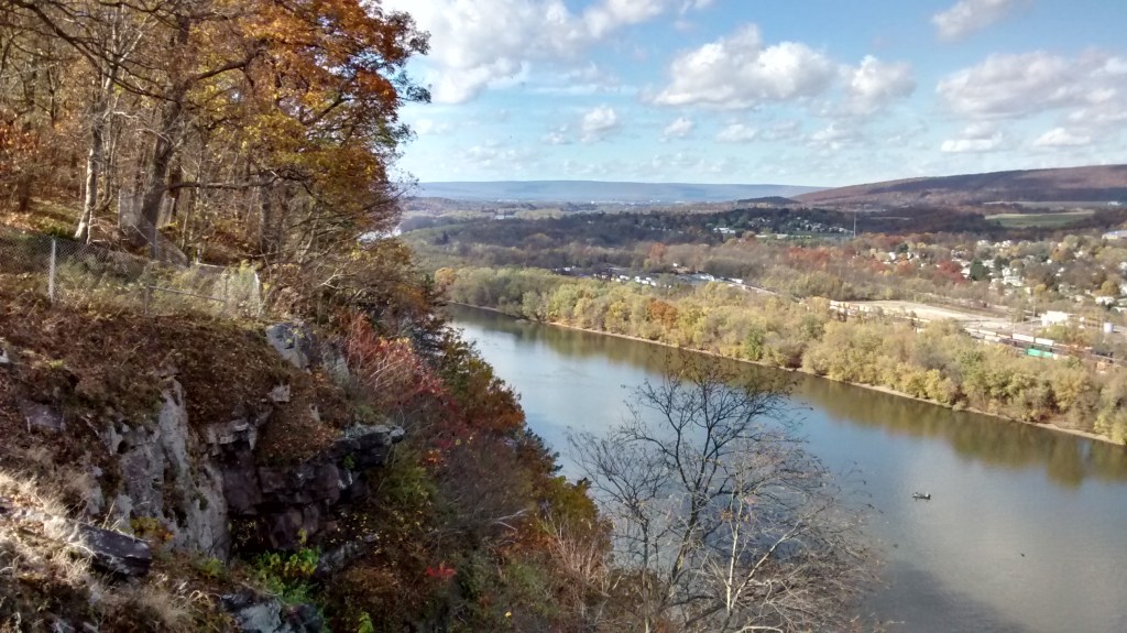
This website has introduced a process to discover and present objectives, focusing on the public sector agencies, and also on climate, biodiversity, and agriculture in particular. It asserts that only a comprehensive, all-sector approach can succeed – the solutions must be considered together. And to some extent, the process must happen at all scales, from local to global. But one scale naturally takes center stage, and that is what is called regional, or watershed, or ‘area-wide’ planning. And this Appendix 3 will look at that area-wide scale, with a narrower focus on how regional plans can be set up for conserving ecosystems – habitats and species. It is just one part of the larger process, that must by necessity include water resources, fire, social issues, etc. But since bio-systems are in particular jeopardy, and cannot be recovered once extinct, we focus on that component here. This is a more in-depth illustration of how GRAP and Re-alignment can be applied for a given issue.

Part 1.  Methods: Setting regional objectives for habitats and species

General outline of possible area-wide planning method for habitat and species of concern.   New, revised planning methods may be applied using existing maps, models and data, to develop a consistent, national process, under expedited timeframe.

Inputs:

Habitat maps – NRCS soil maps –  ESD’s (ecological site descriptions) provide a 100% area-wide map of potential habitat types –– for most of the U.S. lower 48 states.  

Many other sources of habitat maps and data are also available, to complement ESD’s .  In contrast,  past planning efforts may have sometimes been limited primarily to actual sitings data.

Species distribution data:   focus on ‘species of concern’.  These maps include a very wide collection of species, varying by state and by agency. 

GIS data layers:   Zoning maps,  Land Use, Land Cover,  Cadastral.   Future Land Use, if available

Ancillary GIS data layers – a  wide variety of ancillary GIS data will be needed for the process.

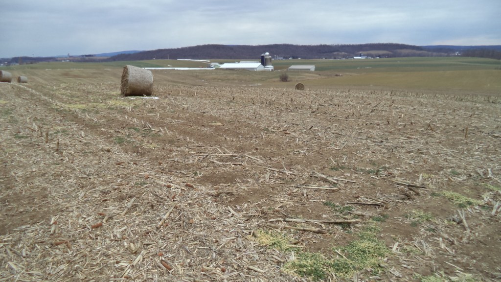
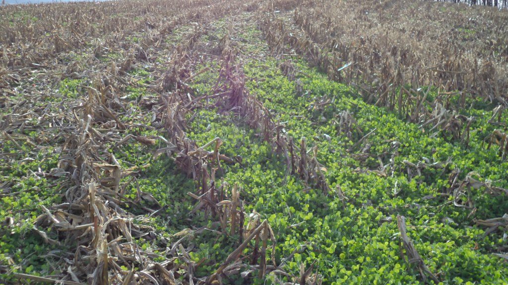
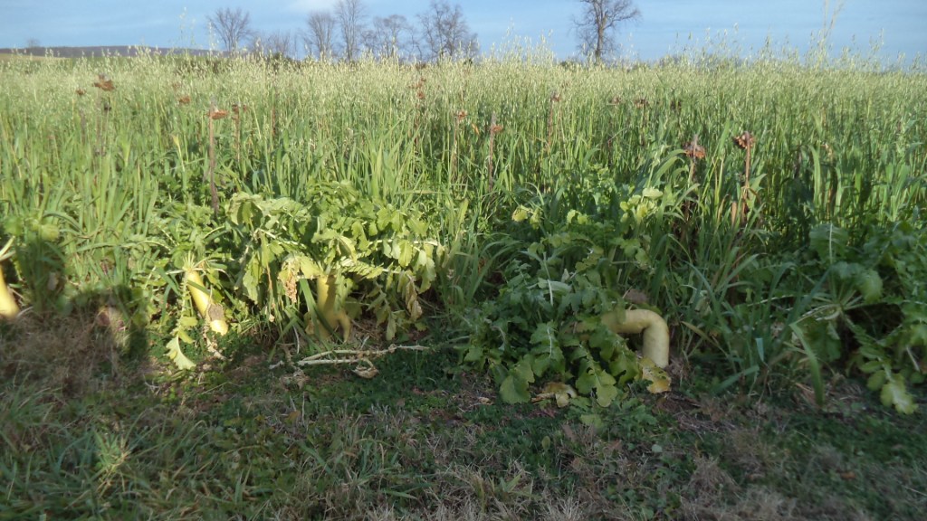
Current land quality and condition –  What is the current condition of each land unit, compared to ‘historical’?  How well can existing land uses support historical habitat and species?   For each land unit, a rough assessment (ie. Scale 1 – 5) of current quality and condition, relative to ecological function, needs to be made.  This determination may be based on land use (ag, industrial, residential density),  ecological impact  (degree of wildlife exclusion) and other factors.  For a simplistic start, assumptions may be based primarily on an existing LULC data base, with minor modifications.  Ancillary data, such as NDVI imagery, may be instrumental in assessing current conditions.

Steps in the process:

The following is a rough initial summary of a simplistic approach based on Ecological Site Descriptions (ESD’s).  Actual methods may vary considerably, due to pre-existing plans/methods, and in order to improve accuracy, acceptance, and overall value in the wider planning environment.   Each state or region may alter or refine the methods for their unique needs.   Consistency, and a collective approach, are still primary concerns.

  • Area-wide (100% land area covered) habitat maps are prepared based on ESD’s and/or other available data.  ESD definitions may be used as the actual habitat variable for each land unit, or they may be translated in to other categories that are more acceptable or adaptable.  Hopefully, any translation or substitution to other classification systems should improve the accuracy and utility of the data base.  Conforming to pre-existing methods may not be advisable.
  • Species of concern are identified and, to the extent possible, mapped.   Species distribution can be based on actual sitings, habitat maps, models, and other variables.  Distributions have been mapped throughout the US, but the accuracy, methods and extent are extremely variable.  For the bulk of species, distribution will probably be inferred, based on their association with habitats and other variables.  This last point may be the critical factor that makes the whole process feasible.
  • Planning objectives for each habitat type are set, using a collective, interagency approach.   At this stage, a rough estimate of the portion of the original (historical/potential) habitat that must be preserved/restored, at a minimum, will be set for each habitat type.   Timelines are included.
  • Planning objectives for each species of concern are set, in the same way.  A sustainable minimum % of the historical population levels will be set.
  • A hypothetical planning map of future habitat conditions, area-wide,  is prepared , with the objective of meeting the above habitat and species targets.  Each land unit will be assigned a planned habitat classification.   (Note: ‘land units’ boundaries may correspond to the NRCS soil units, or aggregations of those soil units based on ESD and other attributes.)   Factors that may be taken in to account may include:
    • Landscape ecology –  patch size, connectivity, etc.
    • Habitat/species conservation objectives (above).   % to be conserved for each habitat and species.
    • Comprehensive plans and planning
    • Current land use attributes (zoning, land use/land cover, future land use, cadastral, etc. )
    • Current quality and condition of each land unit, relative to biodiversity (see ‘inputs’ above).
    • Potential for change / modification / conversion / restoration for each land unit.

Part 2.  Implementation:   Meeting Objectives for Habitats and Species

The above discussion is a general outline that pertains to any given jurisdictions.  In all cases, ecosystems can not be sustained unless objectives for habitats and species are first established.   That in itself will be a serious challenge for many parties – in particular, translating the objectives in to area-wide plans – ie. ‘Build-out’ maps.   The next step will be implementation, including zoning, enforcement, funding, and education.  

There have been many different approaches, and different outcomes, in this field.  This section will look at the current status of such approaches in different regions, and how implementation might be optimized. Some of the critical issues that affect outcomes will be addressed, including:   

For each of these seven issues, see further discussion below:

Establishing a Baseline

This is a critical and fundamental issue!  It matters greatly, because some landscapes are relatively pristine, some are completely ‘developed’, and most are somewhere in between.  Three general options for setting targets come to mind.  The first, and perhaps most widely used today, is to examine the current landscape and species (by inspection and available records), and seek to preserve some portion of it.  In other words, if the habitat/biota is not evident, via actual sitings or ‘occurrences’, then it is not a management concern.   On the other extreme, one considers the historical (as in, pre-development, aka. potential) conditions, and target a certain portion of that for preservation, such as 25%.    A third method is to consider all species and habitats of concern – generally based on historical conditions — and set a sustainable level to conserve.  This last method may be the most pragmatic and defensible.  In any event, one question is whether the information resources are available to make these decisions.  Ie. Do we have maps of historical habitats? Do we have accurate sitings? And do we know what population levels are sustainable?

One final point – do we want to try to save all species and all types of habitats?   There appears to be a general consensus in favor of preserving all species –  particularly those that are locally historical and native;  but perhaps not for preserving every type of habitat.  It is especially critical if those species or habitats are seriously endemic, and not found in other locations.

Which areas are included in the analysis?

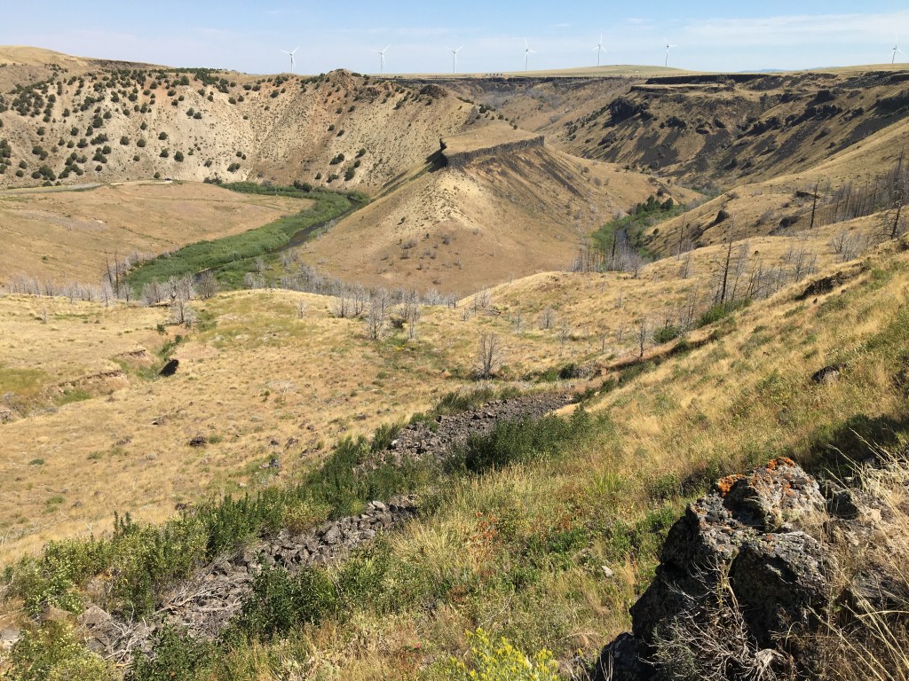
This question is related to the first issue, establishing a baseline, as follows:  if the objective is to conserve only a portion of remaining biota – that which is currently evident – then the emphasis will be on relatively undeveloped areas – primarily forest, farm, range, parks, etc.  If the historical or potential condition is used as a baseline, then the entire landscape (area-wide) is under consideration.  If ‘sustainable’ is used as a target, it may not be constricted by either current or historical conditions.   But in actual practice, all this will vary.  For example, planners may base the targets on historical and potential habitat, but apply that strategy only in certain locations, such as public lands.  Or, those targeting only a portion of the remaining, visible populations may include urban and residential areas as significant habitats.  Or vise versa.  From Nature’s point of view, a whole landscape or ‘area-wide’ strategy is probably best, but each case will vary.

Resources:  Are the tools and resources available?

The short answer is, surprisingly, YES.  But with much room for improvement.  A quick review indicates that tools and resources are available for the U.S., and many other countries, to put at least preliminary area-wide conservation plans in place for biodiversity.  But these will need to improve during the course of implementation via monitoring and better source data. 

There are millions of species, and thousands of habitat types, in all degrees of scale and resolution, accuracy and definition.  In short, the topic can be infinitely complex.  Every landscape is different, under different management regimes, and changing in ways that are hard to predict or to control.  Development pressure is intense in many regions, and has generally outpaced conservation. All told, it would be easy to conclude that biodiversity will be hard to salvage, if not impossible.  Many experts today are pessimistic.  All of this argues in favor of the need to set very clear targets and a realistic implementation strategy, without further delay.  

Resources of greatest concern in this process include:

  1. Data: 
    1. Species: While there may be millions of species, they have been narrowed down to a ‘manageable’ number of ‘species of concern’ for planning purposes.   In practice, these selected species can be associated with certain habitat types and conditions (patch size, etc).   If habitat maps are available, then species can be mapped by association.
    1. Habitat maps:  Habitat maps have progressed considerably, along with related map themes such as land use/land cover (LULC), soils, cadastral (land ownership), zoning, management practices, imagery, topography, hydrology, and many others.  Together, these data layers make it possible to create fairly accurate habitat maps for any region.  Such maps are currently available for large sections of the U.S., while more general maps fill in the rest.  The more general maps may suffice for the first stages of conservation planning, but will need improvement during implementation.
    1. Soils:  Soils are a special case.
    1. Occurrence data:  citizen scientist…
  2. Staff and funding:

Methodology

There is no shortage of methodologies.  The question is whether a consistent, affordable and widely acceptable process is available, and ready to apply.  After many decades of development, it appears that that is the case.

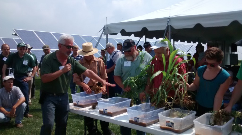
There are many good examples of successful application.  One such case is the State of Vermont, which has developed a consistent statewide program that relies heavily on a holistic and collective approach.  Participants include, in short, everyone, from Federal agencies and global NGO’s to municipal planners and the general public.  The process of conservation is developed, presented, and implemented collectively, easily accessible to any parties via internet.  As a result, Vermont presents a comprehensive and fairly concise education in the practical field of conserving habitats and species of concern.  The same could probably be said for many other states, watersheds, parks, and organizations, filling in gaps for each region and its unique environmental circumstances.  In short, it appears that neither methodology nor access to information are limiting factors.

Costs, Impacts, and Compensation:

There will be winners and loser in this process, and this presents the greatest obstacle to implementation by far.  Otherwise, it would be fairly easy to create an ideal map for conservation, and give local planners the pleasure of bringing it about.  The hard part is implementation.

Ideally, the costs of those who are impacted by conservation can be compensated by those who benefit.  Costs can be transferred via taxes, fees, incentives, subsidies, etc.  This may include developers, realtors, sellers, tourists, and the general public.  In short, almost everyone benefits from conservation except those who are restricted.  If methods to assess and collect such benefits can be put in place, then others can be compensated. 

In some states the land is mostly private (VT, Iowa, Kansas) and in others, mostly public (Idaho, Utah). . (Vermont, for example, is 80% private land, mostly rural).   But in either case, public or private, it is unlikely that any significant portion of land will change ownership, or even change the general land use practices, due to the conservation programs.  Organizations such as Nature Conservancy and USDA have come to see the limitations of easements and land purchases, and shifted emphasis to modifying practices overall and precision conservation at key locations (farmsteads, road crossings, riparian buffer strips, feed lots….).  Options may be more available on public lands, but there is often fierce resistance from affected stakeholders.  In conclusion, to re-iterate-  these costs may represent the main obstacle to success.  The main solution may lie in a transparent, consistent, and totally collective approach.

Challenges

The public certainly cares about nature and biodiversity.  And so do corporations, increasingly. The conservation ‘movement’ is gaining momentum rapidly, and going mainstream.  The problem is that this movement is late in maturing, and it may be too late to change the inertia of the status quo in time to avoid disastrous consequences.  While nearly everyone may care, there are relatively few who are directly engaged, and funding is miniscule compared to industry, medicine, military, etc.  In short, it is time to take a very hard look at the current state of biodiversity, and realistic methods to apply.

There are thousands of agencies, and programs, and funding sources, and organizations that play some role in conservation.  This may be part of the problem.  Unless there is a way to bring these efforts and resources together quickly, then the historical declines will continue.  Vermont and others have demonstrated such a process.  A collective approach is needed, and is well underway in some places.  It benefits from modern tools such as the internet, info tech, data acquisition from satellites to cell phones to soil moisture sensors, and it is driven by a cultural revolution resulting from such resources, along with pandemics, floods, fires, conflicts, and this rapidly changing world we live in.  All these tools and changes can be optimized to bring about a unified and concerted response to managing our environment. 

area wide plan outline1.docx 

Discussion and appendices 

Implementation

  • Work plan for implementation prepared.   To include:
    • Who is involved in this process  (must be collective).   Leads assigned.  Roles assigned.
    • Resources
    • Methodology (above)
    • Timeline, including schedules for plan updates and assessments.

Discussion

  • Implementation Timelines – short (2 yr);  medium (5 yr);  long (10-20 yr +) 
  • Short term –  most will involve rapid management adaptations without changes in LU/LC, ownership, zoning, etc.   Example – rapid transition from conventional to sustainable farming/forestry practices,  via direct agency supports.
  • Very high value ecofunctions, such as key corridor connection opportunities, should be rapidly converted following initial assessments.

(On the positive side, extinctions are hard to justify, and preservation of nature is a universal value, in theory). 

Appendix 2   The Interview Process 

hard structures

Talking to government  —  Understanding an ORG

This section will explain some of the characteristics of public sector orgs, and in many ways will also apply to corporations, Non-Profits, and other types of organizations. The purpose is to show some of the groundwork that will help to gain access to personnel who may help answer questions related to key objectives. It will also help to understand the agencies for the purpose of framing the questions, and later to follow up on the credibility of agency plans and their ability to carry them out. Here goes:

If you want to get an agency (eg. EPA, DOT, USDA) to do something for you, you will first have to get to know that agency to some extent.  By doing so, you gain their respect and willingness to interact.  If you want to understand what the agency is all about, you have to be ready to ask the right kind of questions.  For some of these questions, there may be no answers, or they may be overly sensitive. So pick your way carefully and don’t ever be pushy. Just do your own homework, study what they give you, and keep working on the questions.  Above all, be persistent.  Be professional, respectful, be friendly, but be persistent.  And act the way that you would like to be treated.  Conflict is almost never the best option.

After you get a quick working profile of the organization, then you will be in a position to ask them what they are really trying to accomplish, in the way of outcomes  — the outcomes that you care about.

An agency is like a living organism, that has structure, and substance, and spirit.   Spirit, for an agency, is like their ideals, their culture, their vision.  Hard to put your finger on.  Substance includes their resources, and funding,  and flow of communication  —  also hard to pin down.  Structure, then, is the best place to start.  Within an agency’s structure, you can start to frame your questions. But how do you get a handle on it?   There are many different ways that an agency can be structured – so here are some of the main ones:

  • Start with an organization chart.  It shows all the parts, who’s who, what’s what.  Along with that find contacts, phone numbers, titles, etc.   Now you have handles.  This info is often presented online, close to the  agency’s home page.
  • Mission Statements:    Now look for some descriptions of the parts.  Every part of the organization, from the top down, has some means of defining what they do –  every department, division, bureau, office, etc.  Every employee has a job description, somewhere.  These descriptions may be very detailed, or not.  If you are lucky, you will find mission statements early on for the main parts of the org.  This is as far as many folks will get.  But press on…..
  • Planning structures
    • Strategic Plan–   ie.  5 year plan.   This is a general, over-arching document that describes what the agency expects to accomplish in the longer run.  Many agencies have stopped writing them, but not all.  See the 2023 Farm Bill, for current directions.  
    • Business plans – a more dynamic document, that describes what is happening in the shorter run, ie.  Yearly.  It is a work plan for the agency.
    • Work Plans –  Every serious project or initiative needs a work plan, to spell out the objectives and get everyone on the same page.  They should be dynamic, changing as the project moves along.  Work plans are especially useful if mulit-agencies are involved, to inform cooperation.   They come in all kinds of formats, and various names, but generally need to  include:
      • Purpose of the project
      • Objectives, goals that will address this purpose
      • Methods – How they’re going to do it
      • Resources – what they need to have to get it done.  Funding, staff, data, etc.
      • Personnel  – who is involved, for what tasks.
      • Time frame – when will different objectives get done

Work plans can apply to large projects, or to smaller tasks or casework.   They are very helpful if you can get them, but don’t expect it  — some projects just wing it, or they may be considered internal docs, not for public. 

  • Core mission or authorization –   What are the laws, regulations, authorizations, delegations and other parameters that define the purpose and responsibilities of the agency (in simple terms)?   Check some history, if needed.  How did the agency get started?  Is current function consistent with this stated purpose?
  • Programs and Projects  -( To be developed)
  • Budgetary structure  – follow the money.  For many agencies, this is the most informative and accurate way to define priorities and intentions.  Good luck getting it.
  • Partnership –  You can tell a lot about somebody if you know who their friends are.  It’s the same with organizations –   partnerships define them to a large extent.  And how do they relate to the partners?  Are they shmoozy or shy, dependable or unpredictable?  Some agencies will work with anybody who shares the same concerns.  Others will not even share info with themselves, much less others.   Things to ask about:  
    • Are partners and other resources presented on the website —  links page?
    • Do the partners make plans together?  Strategic plans, etc.  Do they provide input on eachother’s strategic docs?
    • Do they share resources, staff, projects, data, funding…
    • Do they collaborate on projects, programs….
  • Hard copy filing – How does the agency maintain its files?    How are they shared, and who uses them?  Are they open to the public?  Can you request to see them?   In most cases, you need to make a records request, and staff will make the search and bring them to you, if available.   Hard copy is still very important –  All earlier records were hard copy of course, and few if any digitized.  Don’t be surprised if these files and folders were managed poorly over the years, with much loss and attrition.  But you might luck out.   Hard copy files used to define how an agency functioned, back in the olden days  — much like data structures do today.  You worked inside the filing system as you got to know your job.
  • Data Structure  When it comes to sharing,  an agency’s overall data environment can be very confidential – it is so critical to the mission, function and identity. Consider this:  an agency’s mission can be summarized as follows:  they inherit a body of data and info;  they do something to it;  and they pass it along to the next bunch.  That is one way to describe government work as a whole.   What they do with the data reflects everything they are, and is a major part of their power and wealth – along with a few other items –  institutional memory,  equipment, personnel, skills, reputation…    Among all of these, data may be the most important in terms of function, long term value, and what can be communicated to others.   It also defines who they are and what they really do.  Consider these factors:
    • Data Structure
    • Data Bases maintained
    • Data bases shared
    • Data disseminated to public
    • Data that is classified, off limits

This doc is a work in progress, but it may give some insight in to the mysteries of organizations. Of course, this is not focused on remote access and the new realities of current information systems in 2022. But its a starting point. More to come….

Appendix 1 – Mobilization

Newport, Rhode Island

The process of Mobilization

I moved this tedious sounding text to an appendix, for those who might be interested in how systems can get better coordinated, and don’t mind the bureaucratic details.  

Mobilization is related to the currently popular (Google, Amazon, Uber….) concept called OKR, for Objectives and Key Results.  In that respect, it is already a familiar and proven idea to many. The following are possible steps to apply such methods to problem areas:  

  • Maintain systems-wide communication, access and transparency. 
  • Identify major issues and concerns.
  • Define the organization structure, or community, around those concerns.  List the players involved, and their general attributes. If possible, estimate the importance, or level of influence for each player (ie. Due to funding, resources, authorization).
  • Through discussion, discover and communicate goals and objectives of all significant players in the overall system (real, actionable goals).  Compile these objectives using a central, universal database and mapping application. 
  • Establish certain system-wide criteria, or ‘indicators’, that will enable shared vision and focus.  These would be a distillation of Key Results throughout the community.  Examples of such indicators?  For the stock markets, Profit!  For transportation, number of accidents. For Climate, ppm CO2, or increase in average degrees C.  For the Chesapeake Bay Initiative, TN, P, and TS in the water. 

These steps above are the main ingredients in facilitating alignment in a diverse working community.  They will help to enable further actions, such as:

  • Develop and coordinate collective strategies to meet those criteria and wider objectives.
  • Track the results, and continue to re-adjust as circumstances change.
  • Focus on the most necessary, feasible and effective objectives at any given time.  Avoid low-return investments and distractions. Prioritize!
  • Repeat  

Chapter 8 —  The Time Frame

Palenque, Mexico

Major changes can happen quickly, if intelligent choices are formulated under a collective decision-making process.   This is the message constructed in previous chapters of this website.  It has also suggested that the focus should be on agriculture, due to the immense scale of the overall food system, but also because the AG sector is well positioned NOW for changes that will radically mitigate the global climate crisis, along with biodiversity and many other critical issues.  The final message is, that these changes can be relatively simple to activate, will provide mega net profits along with mega net energy savings, and can execute in a very short time frame.  This final chapter is about the Time Frame.

The conversions in the food sector can begin immediately under current management and existing resources.  In fact, it already has.  That conversion can expand to affect the bulk of the food sector in a period of years, not decades.  In general, about 2 to 5 years for the changes proposed.  This chapter will look at some of the variables in the process, and then consider a schedule for the actual changes.

Soil Cover plus wildlife

Variables:

As shown in the previous chapter, many changes are under way, including:

  • Natural areas are converting to farmlands and other development.  And vice versa, as cultivated areas are retired, or degraded, or join programs such as EQIP, CRP, easements, or other options.
  • Sustainable farms – such as traditional small dairies, orchards, etc – convert to conventional operations.  And vice versa, as industrial operations switch to organic, local, regenerative, etc.
  • Family farms are leased out to larger operators or purchased by corporations and investors.
  • American farmland is bought by foreign companies.  And vice versa, as U.S. investors buy into foreign real estate.
  • Rural areas are drained of population as farm operations are automated.  Or re-settled, as urban populations move out to more affordable and livable rural areas.

A move towards sustainable and regenerative agriculture is underway, and there are many intensive efforts underway to describe and quantify it. Many agencies, public/private/and NGO, are working hard on mapping, statistics, and analysis. There is a lot of information available, but, as stated earlier, it is preliminary, and there are problems with data, definitions, consistency – in short, we do not yet have a collective and clear analysis of the farming industry with respect to environmental priorities.  That could change quickly.  Here are some of the variables:

A consistent and accurate mapping process would show how farmland is used nationwide, including all factors (themes) relating to sustainability.  These would include a breakdown of farm categories (cropland, rangeland, pasture, livestock feed, human feed, energy crops, fiber, and a few others).  It would show the type of ownership (public, private, family, corporate, foreign), and the frequency of property transactions.  All of these factors above are already attainable given current mapping layers and resources, with a bit of careful processing.  But here is the hard part:  we also need to see something about the farming methods and conditions for each land unit, related to sustainability.  Is it conventional farming, with industrial and extractive methods? Or is it regenerative farming, with cover crops, prescribed grazing, and a healthy ecosystem in place? Or, more realistically, something in between? How can this critical information be teased out of the data?  

Those are some of the factors involved in defining and analyzing the potential conversion towards sustainable farming.  Some other key factors include: is the farm operation subsidized or constrained by external interests (marketing, transportation, research, legal, regulatory, energy, security, consulting, cultural, etc.).  This sounds complex, but it is in practice fairly simple – most farmers have few if any options for method and marketing in the current industrial set-up.

Another key factor is property transactions, or sales.  A large portion of the farm population is aging out and those farms are up for sale.  At the same time, there is a very hot global real estate industry with a growing focus on farm land.  Investors around the world are buying up farms, and not just in the Congo and the Amazon.  This is a key variable, that needs to be in the map.

Natural areas are converting rapidly –  into farmlands, primarily, but also to urban, commercial, etc.  While this is rampant and apocalyptic in Africa, South America and South Asia, it is also happening in the U.S., Canada, and Mexico.  Such ownership changes and trends need to be obtainable via GIS data layers, including land use/land cover and cadastral (parcel data).  What direction will these new land purchases take in terms of sustainability?  Some may convert to greener methods, and others to more ‘conventional’.

A collective approach to Area-wide planning is needed to meet conservation objectives – that much has been clearly established (see Ch.5).  Some states and regions have instituted this planning, but most have not, and there is a long way to go even with those that have.  This is a critical factor in the conversion to sustainable land use, and our land use maps need to show it.

Many other factors may be useful in the analysis, and could be incorporated into the map.  For instance, how close is the farm to an urban area or other population?  This could affect the ability to use dangerous pesticides, excessive tillage that causes dust and runoff, and other practices.  Such spatial variables are very easy to extract with mapping/GIS analysis.

All of the above are variables that could help to illuminate and accelerate the conversion to sustainable agriculture.  But none of them are pre-requisites for that change.  Major changes can be initiated without further study, science, politics or conventional planning and strategizing.  Consider this:  How long does it take to stop burning down a forest?  Or to stop passing out misguided subsidies?  Or to allow local slaughter houses to process local beef?  Or to allow local consumers to buy that beef? Or to stop supporting toxic regimes, or toxic merchandising ?  How long does it take to stop throwing resources away via outdated and destructive practices? And how much of those resources could we then redirect to sustainable practices?  With that in mind, here is a rough schedule for changes in agriculture: 

In the following schedule, here are some of the changes that will need to happen:

  • Conventional farming methods will change to sustainable and regenerative.
    • Buffers/ corridors/ riparian habitats will be established.  This often involves ceasing to plow up those areas.
    • Fallow lands (bare or weedy soils) will convert to planned crop covers, such as ‘cover crops’, multi-cropping, etc.
    • Previously ungrazed croplands will institute grazing for at least part of the year over perennial forages or annual cover crops.
    • As a result, lands that were used to grow animal feeds (corn, soy..) can be reduced, while those used to produce crops for human consumption can increase.
    • Chemical fertilizers will be reduced and supplemented by cover crops, animal manures,  improved soil biology, innoculants, etc.
    • Pesticides (herbicides, insecticides, etc.) will be reduced or obviated by natural farming (regenerative, or ‘agro-ecological’) methods.  Balanced natural ecosystems generally require little or no pesticides.

The following Schedule is pragmatic, and optimistic.  It is very incomplete – only a few of the many planning variables are presented, as illustration. These kinds of changes would require a very dedicated mobilization of resources and participation, and a willingness to abandon the status quo in many respects.  But the benefits would be incalculable. 

The shift from Conventional to Regenerative farming could be 50% initiated within a couple years.  As mentioned before, the benefits begin as soon as industrial crops and chemicals are halted, cover crops are introduced, and the land is allowed to start healing.  This can be started immediately.

In the first year:

  • Notify the industry that all subsidies to unsustainable farm operations will be suspended – these  changes could start to execute in year 2.
  • Reduce tilled areas.  Add buffers, etc, beginning with riparian areas as a top priority.
  • Initiate basin, or area-wide plans – a 3 year process to complete first phase.  Compile all necessary base mapping layers – habitat / species / land use and land cover, etc.  in year 1 —  from existing info resources.
    • Map all relevant farm features, such as tile drains, drainage ditches, processing areas, waste and chemical storage, in year 1.  See Vermont examples for detail.
  • Subsidize regenerative processes
    • Design and implement cover crops in the fall of year 1. In general, no soil surfaces should stay exposed for long periods.
    • Design all grazing infrastructure and rough grazing plans for individual farms, to be implemented starting year 2.
    • Design and start to implement regenerative and Best Management Practices – BMP’s for all participating farms. 
Susquehanna River at Winfield, PA

Longer term actions:

  • Drop all subsidies to concentrated animal feed operations – CAFOS – 3 year process.
  • Subsidize and support rural development (USDA/RD) – 3 year process to fully initiate.
  • Redesign the regulatory framework from conventional to regenerative methods – 3 year process.
  • Shift funding from individual farm contracts to universal programs and strategies – 3 year process (see Ch.5 for details).
  • Institute a national Crop Genetic Conservation Program on an emergency basis, year 1 (USDA/ARS and NRCS). This includes a national grow-out program (aka: ‘in situ’) similar to the BLM strategy for conserving/developing native plants resources.
  • De-subsidize GMO crops and related chemicals (glyphosate, neonics, etc).  Shift subsidies to support rare, endangered, heirloom, heritage, native, local, and threatened varieties in the public or private domain.  Implement these changes starting year 2.
  • Phase out all hazardous chemicals, especially highly toxic, persistent systemic residuals, such as ‘neonics’, in 2 years.
  • Decrease the acceptable thresholds for soil erosion (‘T’) by 10% per year, towards sustainable levels.  Subsidize and regulate these changes.
  • Institute a program to map and manage tile drains on farmlands and food processing facilities.  All emissions from tile drains should meet water quality standards by year 3.

The above changes are not comprehensive, but are intended to give a rough idea of the time frame for shifting to sustainable practices, with a focus on agriculture. Without mobilization and a collective approach, these kinds of changes can take decades. On the other hand, under a war time footing, they can happen in months, as we have seen with the crisis in Ukraine. Neither months nor decades are desirable, but a rapid and smooth transition is possible under circumstances suggested in this website.

Please share these ideas, post your comments, and stay tuned for further developments.

Ch8—TheTimeFrame.doc

Chapter 7 – The Numbers

How fast can things change?

The previous section described some of the major changes that could take place as conventional agronomic crops shift to more sustainable and regenerative practices.  But this conversion is only one part of the picture.  Other rural land uses that could convert towards sustainable methods include:  pasture and dairy;  forestry – silviculture;  orchards, and fruit; natural areas; desert and barren lands.  And development, of course, will play a big role, as farm acreage converts to urban, residential, etc. 

This Chapter will only attempt to give a rough sense of the scale of the changes in agriculture that could have an immense impact on climate change and biodiversity.  It is not possible to provide much accuracy here, due to problems with definitions, data limitations, and overall consistency.  It is, in short, a work in progress.  But a sense of the overall scale involved should be informative.

A report published by Bloomberg gives an excellent summary (and visualization) of agricultural land use in the ‘lower 48’  (see https://www.bloomberg.com/graphics/2018-us-land-use/   ) .  Bloomberg and other sources are quoted by Ronnie Cummins in the book Grass Roots Rising, as he attempts to quantify the statistics in question here.  Here are some of the rough results:

  • In the Lower 48, there are:  654 million (M) acres of pasture or rangeland, 539 M acres of forest, and 392 M acres of cropland.  (-Cummins quoting EPA data)
  • US pasture and rangeland covers more than 1/3 of the total land area in the Lower 48.   Of that, 158 M acres is administered by the US government, mostly out West. Much of the total pasture and rangeland in particular is degraded and poorly suited to grazing as currently practiced.
  • Another 127 M acres that the EPA classifies as croplands are used by farmers to grow animal feed for livestock, mostly GMO corn and soy.  This means that the livestock grazing and feed production portions of our agricultural lands together add up to 654 plus 127 – a total of  781 M acres, which constitutes 41 percent of all the land in the Lower 48 states.
  • Of the croplands (392 M acres), approximately –
    • 38 M acres used for corn ethanol or soy biodiesel – energy crops
    • 77 M acres for food products consumed by humans in the U.S (not meat, dairy, etc)
    • 127 M acres for livestock feed, as stated above
    • 22 M acres for wheat exports 
    • 69 M acres for other grains and food exports
    • 14 M acres for cotton
    •  52 M acres idled or lying fallow in a given year

WHAT DOES THIS MEAN?  In short, there are about 400 M acres of croplands that could be used for regenerative agriculture.  I do not have a breakdown, but if 100 M acres are already in some degree of regenerative use, then about 300 M acres of croplands may be available for conversion and upgrade.  That conversion will require grazing or other animal presence, by definition (see Chapter 6).  As grazing on formerly ungrazed croplands increases, it will reduce demand for feed from the 127 M acres used to produce animal feed (mostly GMO corn and soy).  And it will also reduce demand for much of the existing pasture, range, feedlots/CAFO’s and factory farms.  One reason that these reductions will be significant is because the croplands tend to be much more fertile and productive (due to water, soils, slopes…) than current pastures and rangelands, especially if prescribed or rotational grazing methods are used.

What happens when millions of grazing animals are relocated from rangelands and feedlots into formerly conventional farm operations?  Currently, much of the grazing is happening on ‘rangeland’, areas which are otherwise ‘open’ or ‘natural’ land, and not well suited to crops (due to slopes, soils, moisture…).  How much of that grazing capacity could be shifted over to regenerative croplands, and what would that mean for climate, biodiversity, water quality, etc?   How many million acres are involved? 

WHAT ABOUT FOREST LANDS?  There are about 540 M acres of forest in the Lower 48 states.  As existing croplands convert to incorporate grazing as part of regenerative methods, much of the current rangelands and pasturelands could be converted to forest or agroforestry (the combination of forest and grazing is termed ‘silvapasture’).   At the same time, there is another 250 M acres that has degraded or treeless landscapes (not urban or cropland) that could be reforested, especially in the South , Southeast , and Northeast (Crowther and others).  This would be mostly in addition to the existing range and pasture land, which is largely in the Western U.S.  In total, therefore, the US could develop an additional 400 to 500 M acres of forest in the Lower 48.  If that sounds far-fetched, please note that Japan, a densely populated and industrial country, is 85% forested.

In summary of the above, to see the scale of possible changes:

  • Much of the 654 M acres of rangeland and pasture lands could convert to sustainable levels or other land uses, if not already doing so.  Much of that land could convert to forest or natural areas, with huge benefits to climate and biodiversity.
  • About 400 M acres of croplands could shift into regenerative status, if not already doing so.  
  • About 250 M acres of degraded or treeless landscapes could also be reforested, bringing total added forests to 400 – 500 M acres.

As inferred above, the current management style and environmental status of farmland is not well documented in existing GIS layers.  Any given farm operation could be very beneficial or very destructive to the surrounding ecosystem. Therefore, I would be speculating to even estimate how much of the above acreage is actually suitable for conversion to regenerative methods, and how fast.  But these numbers do help to illustrate the scale of the issue.  There is a potential to convert 500 M  to over a billion acres of land in the U.S. in the direction of regenerative agriculture or additional forest.

What effect could this have on climate, biodiversity, etc.?   Immense.  Here is one last set of numbers to consider in that regard —   To give a sense of the overall relevance of the ‘food’ sector, Ronnie Cummins states the following in Grassroots Rising: 

“Our strongest arguments are that global industrial food, farming , and land use practices (chemical – and energy – intensive farm inputs and production , processing , packaging , refrigeration , transportation , deforestation , and waste ) are generating a full 43 to 57 percent of all current greenhouse gas ( GHG ) emissions……”.   

Changing the production methods in agriculture can lower emissions drastically. But perhaps more significantly, these regenerative methods can also sequester a massive amount of carbon and other greenhouse gases such as NO2 and methane.  Rather than a massive source of emissions, the industry can become a massive sink for carbon sequestration. 

In the next section, we will consider how fast these changes could be implemented.

Ch7—TheNumbers.docx

Chapter 6 – The changes

Switching from Conventional to Sustainable

Farming on a slope

Agriculture appears to be undergoing a serious transformation –  a new paradigm, sometimes called ‘Regenerative Agriculture’, or ‘Agro-ecology’, is turning conventional (aka: ‘industrial’) agriculture upside down.  At the same time, the Green New thinking and Climate Change are rapidly reaching a crescendo in public awareness.  But few people are aware of the impact that this new version of ‘AG’ could have on energy, climate, and the global crisis in general.  Much less do they comprehend the speed at which those changes could take place, in agriculture, compared to other sectors.  We need to look at those numbers.

But first, what exactly are we talking about, with these radical changes in agriculture and the overall ‘food system’?  We have already looked at many aspects that could improve, including: area-wide coordination, habitat protection, ecosystem benefits, soil health, and water supply management.  But these are abstract topics to most people outside the field.  What do the differences look like in practice, in ways that are easier to understand?  Let’s take a closer look, before running ‘the numbers’.  What do ‘conventional’ and ‘regenerative’ agriculture actually look like?

Conventional

The majority of cropland in the U.S. is still under conventional managementpicture a typical GMO corn/soy and hay operation.   A conventional farm is set up to maximize gross production in the short term, with little concern about long term impacts and external costs.  It assumes that technology and science can evolve to counter any natural deficiencies. Soils may be degrading, but fertilizers will evolve to make up for it. Pests may be increasing, but better pesticides will be coming.  ETC.  A conventional farm attempts to use every square inch for cash crop production, made as level, uniform and unobstructed as possible, so that machinery with 90’ widths can crisscross easily.  Hedgerows, windbreaks, streams, ponds, outcrops, wetlands, trees, cemeteries, hiking trails, etc.  –  all are removed or minimized.  Wildlife is actively ‘excluded’.  Monocultures of agronomic commodity crops are grown, such as corn, soybeans, wheat, sugar beets —  almost all annuals, and largely GMO.  In between growing seasons, soils are managed only to optimize the cash crops and the bottom line, which usually involves repeated tillage and little or no ground cover, leaving bare soil surfaces to erode via wind and water.  Crops are wholesaled in a globalized vertical marketing system, leaving few options to growers.   Pesticides and fertilizers are heavily applied.  Conventional farms use very high levels of inputs and machinery passes to maximize the gross output of cash crops, in accordance with markets, loans, subsidies, and production dictates.  Human labor is minimized – the process is almost entirely mechanized and automated.

Regenerative

Regenerative farms see natural processes as a benefit rather than competition.  Ecological systems, along with pollinators, microbes, are the basis for production.  Farming is considered stewardship rather than resource extraction.  The general layout of a regenerative farm may look very similar to conventional farms, but the ingredients are very different.  Instead a dominant cash crop, growers choose from a full spectrum of plants and animals, fine tuned for a variety of functions.  Plants include cover crops, inter crops, companion crops, multi-cropping, and many other roles.  This mimics nature, aka: ‘farming in the image of nature’.  Locally adapted, heirloom, or indigenous plant species are assumed to have innate advantages.  Natural features (birds, insects, pollinators, trees, shade, windbreaks) all have functional roles to play.  In general, the gross output of each cash crop may be lower than with conventional farms.  But the overall inputs in terms of fuel, tillage, transportation, fertilizers, pesticides, etc. are greatly reduced.  Best of all, the NET profits are likely to be better than conventional,  even in the short term.   If longer term benefits are considered, regenerative is clearly a better system, by any measure – according to its proponents.

By engaging with natural systems and a wider range of species and methods, regenerative farming can be much more complicated to design and implement. A wider range of knowledge, expertise, specialization,  tools and machinery are generally required, encouraging economies of scale or collective multi-farm, cooperative approaches.  Labor and rural development are likely to scale up to meet these needs.  In comparison, conventional operations may look very simplistic and uniform.  They can be clean to the extent of barren, literally.    

For an exhaustive definition of ‘regenerative’ farming, see a paper by Jonathan Lindgren at – https://f1000research.com/articles/10-115/v1

Making the Change: The critical question:  what does it really take to flip from conventional to regenerative ag?  I believe that it can happen very quickly, if external factors can be mobilized. As mentioned above, the general layout of operations may change very little,  while the features will change a lot.  But most of that change will involve scaling down operations, rather than scaling up.  Much of the change is a matter of what is not done, and not disturbed, rather than what must be added. Buffer areas, natural areas, perennial crops, grazing areas, No-till or minimum tillage, can all drastically reduce the level of inputs and impacts.  While each such farm will continue to develop and change over time, the initial conversion, in a crude sense, can happen very quickly.   The Ecosystem and climate benefits begin as soon as the conventional operations stop.

A switch from conventional to regenerative methods is just one piece of the puzzle – but it is a very big one, with wide ranging effects.  So how many (hundred) million acres are we talking about, potentially, for this change?  The next chapter will take a rough look at some of these numbers, but first:

The BIG Picture

Cows on the Ichetucknee, Florida

There is a larger framework to be considered if we are to make any sense of the upcoming calculations.  The change presented above is not something that only affects individual farms. Rather, it can change a whole industry, and to some extent, a whole culture.  Here’s why.

To make a long story short —  COWS.  Americans love beef, but are not crazy about industrial feedlots.  Regenerative plays right in to that.  Regenerative is widely associated with soil health, and soil health, by current definition and reasoning,  must have a grazing component.  In addition to soil health, that grazing component often makes a critical difference in terms of annual cash flow to those who are going from conventional to regenerative.  Whether it is grass fed beef, dairy cows, llamas, pastured pigs or buffalo, it can generate a very valuable and sought-after commodity, and as a result, these farmers tend to be doing very well with net incomes.  This profitability may help to facilitate a shift of millions of acres of croplands from a status of animal-free to heavily-grazed, for all or part of the year.  The result may change the whole food system, eliminating many remote feed lots and range lands, building local industries and communities, slashing transportation costs and related energy costs, improving diets and health, and changing the look and feel of American landscapes.  For those who fear that sustainable agriculture may threaten their beef supply, it may be quite the opposite. 

A good place for Cows?

What happens when millions of grazing animals are relocated from rangelands and feedlots into formerly conventional farm operations?  Can we handle all that meat? Currently, much of the grazing is happening on range land,  which might otherwise be kept as natural areas, public or private, and not well suited to crops (due to slopes, soils, moisture…).  How much of that grazing capacity could be shifted over to regenerative farms, and what would that mean for climate, biodiversity, water quality, etc?   And how many million acres are involved?

This conversion outlined above is only one part of the picture.  Other rural land uses that could convert towards sustainable methods include:  pasture and dairy;  forestry – silviculture;  orchards, and fruit; natural areas; desert and barren lands.  And development, of course, will play a big role, as farm acreage converts to urban, residential, etc.  Many parties are working on mapping and quantifying these land uses and trends, including the USDA, the Interior Department, USGS, States, universities and NGO’s such as Nature Conservancy.  The finance industry is also very interested.

Idaho Falls

Next: The Numbers

How many millions of acres are we talking about?

Ag_The_Changes.docx

Chapter 5 – The Environment

Climate Change and Ecosystems:  A Collective Approach for a Global Crisis

Climate Change is widely perceived as Global Concern #1.  But it is only important due to the impacts that it causes. Of these, the apocalyptic loss of biodiversity must be Impact #1. These are massive and complex problems, that will require holistic and collective solutions.  All sectors and players need to sign on if we are going to turn it around.

This paper will discuss the general concept of bringing all parties and objectives in to alignment, and specifically, how it relates to agriculture and ecosystems.  In the end, it will provide a more detailed discussion on two of the topics – habitat and ecosystem management – as important examples of the process. 

What are some key issues affecting climate change and biodiversity?

  • Human populations and social concerns are always central to any search for solutions.  Social conditions must be not just sustainable, but meaningful and even equitable. 
  • Environment is a common denominator for most of the top concerns facing global populations.
  • In terms of environment, the parts of the system that could have the most impact for the lowest costs and fastest turnaround include agriculture and forestry – aka: natural resources (NR).  The more developed and industrial areas will generally be harder and take longer to change. 
  • Why is Agriculture so important?   Consider global acreage, energy use, habitat affected, diet and health, labor potential, carbon footprints.  Food occupies a place in the middle of everything, for both humans and nature.    
  • In agriculture, critical modifications could be made very quickly, often with low cost and high benefits, over hundreds of millions of acres.  In many cases, simple adjustments to current practices can also increase profitability, even in the short term. Examples include the sophisticated use of cover crops, precision agriculture, and prescribed grazing.
  • The conservation movement has been well established now for generations. Like all movements it goes through periods of innovation and stagnation, ups and downs.  There is currently a fast-growing trend towards restorative, or ‘regenerative’ agriculture. This is a critical time to act, as methods and motivation are at a high point.
  • Government programs and subsidies have largely determined the shape and substance of our agriculture and natural resource management (NRM). Regulation tends to be lenient in the farm sector, and compliance is often voluntary. Redirecting these mega-factors in favor of sustainability should be considered as a core strategy.
  • To the extent that some industries may be invested in the status quo of ‘conventional’ agriculture and NRM, they may impede change. This could include: chemicals, energy, heavy machinery, investment, transportation, consulting, bureaucracy, and even health care and academia. 
  • On the positive side, the financial sector is rapidly addressing Environmental concerns (ESG) with increasing clarity and impact. ‘Methods and metrics’ are evolving quickly – can this also happen in the public sector?

Why focus on Agriculture?  There are many other strategies, such as: Conversion to renewable energy;  IT advances, including AI and remote access;  changing consumption patterns;  Recycling and conservation.  All are important, but only agriculture offers so many fast and far-reaching options.  What are some of the big issues and possibilities in ‘Ag’?

Major issues related to Agriculture

  1. Area-wide management and planning. Must address current priorities, below: 
  2. Biodiversity.  Rapid widespread decline and extinction, related to:
  3. Habitat loss – Development, abuse, fragmentation and dysfunction – including the rampant and wholesale destruction of tropical ecosystems as a top priority.
  4. Climate change – exceeding worst predictions – impacting environments, economy.  
  5. Fire control and planning.  New, integrated, pro-active approach is needed.
  6. Soil erosion – due to wind, water; off-site transport causes pollution.
  7. Water quality, and water supplies; Dams and diversions.  Flood control. Ice melt.
  8. Wildlife exclusion practiced on farms,  and other operational impacts to ecological function.  
  9. Agriculture subsidies and contracts to ‘conventional’ farm operations.  And possible alternatives.
  10. Global vs. Local food systems.  Shifting the balance.
  11. Social impacts, related to all of the above, and more.  Employment opportunities. Population displacement, and resettlement.

Discussion – Realignment, with a focus on Agriculture

One major problem is that strategic objectives have not been set for many criteria that are crucial to overall sustainability.  In addition, there may be no system of shared accountability or oversite in place to effectively meet the objectives.  The following expands on some of the key areas where clear objectives – and alignment based on those objectives – would be crucial.

Area-wide perspective.  Agencies may conduct intensive environmental review, but overwhelmingly these reviews are on a private, case-by-case basis, limited to one farm or factory operation.  Even where an area-wide scope is required, there may be a lack of information or objectives that is readily available to planners. In most cases, it is not because the information doesn’t exist, but rather because it has not been assembled in a usable format.  Recommendation:  Area-wide reviews, data and analysis could be pre-compiled into a format that is readily available and meaningful to a wide range of planners.  This product, a strategic summation of local objectives, could be coordinated by a diverse group, including conservation coalitions and partnerships.  One example of a collaborative, statewide presentation tool is by PA Conservation Explorer, at conservationexplorer.dcnr.pa.gov/.        

Thousands of natural resource conservation plans are undergoing assessment at any given time, impacting a vast acreage in the US.  Having ready access to better area-wide summaries could have a major impact on the effectiveness of those plans.

Habitat conservation, targets –    Globally, the highest priority by far is to stop the rampant destruction of global ecosystems, particularly deforestration in tropical regions such as the Amazon, Sub-Saharan Africa, and Southeast Asia. 

In the U.S., goals must be set for habitat conservation, based on both existing and potential habitat maps on an area-wide (100% land area) basis.   Habitats cannot be preserved unless clear targets have been set and accurate habitat maps, including future build-out’ maps, are readily available to reviewers.  In considering long term objectives, planners will have to consider existing conditions, historical records, and potential habitats.  Maps and records must be available for each case.  – See further discussion below.

Biodiversity  – Targets must be established for species of concern for each watershed or region –  based on historical and existing records, including both actual sitings and probable or potential presence, for the entire area.  Potential presence can be modeled and inferred based on: soil types (and associated eco-zones), habitat, and many other criteria. Practically speaking, species targets may be established based on their correlation to associated habitat types (See Vermont example). The basics of landscape ecology –  planning and design –  must be included in this process. An early emphasis on riparian zones is recognized as a top priority, in view of past abuses, importance and feasibility.

Mapping ecological status – It is not enough to assign a certain land use or land cover id to a given land unit. For any given land use (ie. Cattle grazing), the ecological effects can vary from highly supportive to highly destructive.   A consistent methodology is needed to assess the ecological status of all land units, which could then be used along with other recorded data (GAP’s, BMP’s, etc.) to map current conditions for farm, forestry, or industrial operations. These maps can be used to help create area-wide assessments, and will facilitate planning and implementation for habitats and species of concern.  Land units that practice intensive wildlife exclusion, such as many horticultural operations, are prime opportunities for conversion to sustainable methods.

Soil erosion, and transport off-site.   Soil erosion is carefully quantified for each field unit in the planning process, using very sophisticated tools that have evolved over generations of soil scientists.  In most cases, however, the calculation is for in-place movement only, and does not quantify off-site transport, which is needed for any area-wide assessment.  Such off-site migration can be modeled using existing tools and data.  For examples, see ongoing regional water quality programs, such as Chesapeake Bay, Lake Erie, Lake Champlain.  Access to accurate input data may be a major concern for such modeling.  

Soil erosion – sustainable threshold.   A threshold for soil erosion is routinely calculated for all planned farm units, and many other applications.  However, the threshold value itself may reflect an historical convention based on perceived feasibility, rather than on a sustainable amount of loss – it may have little or no relation to the actual rate of re-generation for any given soil type.  A value reflecting sustainability should be more widely considered and used for planning and assessment purposes, such as area-wide impacts and off-site migration, as mentioned above.

Carbon sequestration:   Management practices and land uses should be assessed in terms of their ability to sequester or conserve carbon, which is now recognized as a critical priority for Climate Change issues world-wide.  Notably, the ongoing maintenance of living ground cover is a critical factor in CO2 levels and sequestration.  It is also a top priority in terms of erosion control and overall soil health.  Global imaging data, such as NDVI or NRG, can be employed to facilitate this assessment over any size area.  That type of information (along with LIDAR, high res imagery, and other modern tools) could be facilitated and factored in to assessment at all levels, from small farms to whole regions.   

Crop genetic resources – seed saving:   The conservation community should set criteria for conserving the genetic resources of crop plants as well as other species (native plants, animals, etc.).  What percent of historical varieties are we prepared to lose, and which ones?  On the current course, almost all varieties that were developed in the past 20 plus millenia will soon be extinct, as commercial varieties replace them.  This would be a tremendous loss to the industry, and to humanity as a whole.  A national program for the purpose of growing out and preserving the surviving seed collections should be implemented on an emergency basis.

Strategic Plans:   Agencies and organizations that have discontinued strategic planning in recent decades should reconsider the process, as a way to coordinate and inform their workers and also a wider community of partners and the public.  If resources are not available for such planning, then a more streamlined process of outlining OKR – objectives and key results –  should be considered.  It must be a transparent and collective process, emphasizing partnerships and a shared sense of accountability.

Water Supply, Dams and Diversions:   Dams are increasingly recognized as damaging to ecosystems in general.  But in some parts of the world today, thousands of new dams are being planned.  In the U.S., many dams are overdue for maintenance, repair, or decommissioning, and will be up for consideration as a part of the planned massive investments in infrastructure.   De-commissioning offers a vast opportunity for the revival of impacted eco-systems and hydrology, along with many other benefits. However, it would require very intensive, area-wide planning in order to manage the economic and environmental impacts.  For example, can water that was stored in dams be re-directed to wetlands or to aquifers, such as the depleted Ogallala in the Midwest?  Can water customers modify practices to use less water?  How much subsidy to water users is justified? Is there an urgent need to re-balance human vs. ecosystem benefits?  Can other sources of energy, such as wind or solar, replace hydroelectric?  And finally, how can the current flood control benefits be maintained if dams are decommissioned?   All of these considerations will require accurate regional data, maps and funding for assessment.

Ice Melt:  The rapid decline in fresh water stored as ice and snow presents a problem similar to that of dams, but on a much grander scale.  About 70% of the earth’s fresh water is/was stored in solid ice form, and it is melting off very fast. The dangers this presents for countries like India is catastrophic.  (Sea water rise is of course another dire consequence of ice melt). And will it be possible to capture, store, and deliver this new melt water to those who depend on it, in order to avoid catastrophic losses? Finally, how do we handle the newly exposed surface areas?  Millions of acres of frozen terrain must develop new vegetation to prevent erosion.  How can those ecosystems be optimized, and who is working on it? 

Fire Control and Planning:  Wildfire management is under massive strain, worldwide.  Fire issues are related to biodiversity, climate, hydrology, habitat – in short, it is related to all other landscape functions, and will benefit from a regional, area-wide approach.  The maintenance of contiguous riparian and wetland habitats, the expanded use of native plants and cover crops, and soil health in general will all play a part in fire outcomes.

Drones and other sensors:    New forms of imagery and sensory inputs are rapidly changing the whole process of farming, land management and oversight.  However, some public sector agencies have been slow to adopt such technologies.  This could be accelerated with concerted efforts to set up data acquisition through outside contractors, and train staff in its use.  Resources spent on travel can be reduced, while data access and accuracy can be vastly improved.  Many other types of sensor data can be acquired remotely and digitally (water use, fertilizer, chemical application, etc).   Process and procedures to capitalize on this technology should be aggressively developed in the public sector. Programs like universal soil testing (below) will augment these developments.

Alternatives to contracts and subsidies: The U.S. provides hundreds of billions in direct payments to individual operators, in support of various objectives and practices.  The processing of such casework is extremely time consuming, even for small operations.  For the sake of efficiency, these subsidies can favor large scale, conventional and industrial operators, versus small scale, sustainable, diverse, etc.  There may be alternatives to such direct, case-by-case subsidies that are overall more cost effective, benefit a wider community, and produce different results.  See an expanded discussion below, and the example of a universal soil testing program.

Social Concerns:  Human settlement patterns and environmental conditions are very closely related. Humans have, in general, been removed from rural areas, in favor of industrial farm/forestry operations that require little human labor.  However, it is not clear what to do with those who have been displaced.  Is it possible that resettlement back to rural areas and reconnection of people with farming and natural resources is one solution to both social and environmental problems?  The conversion of Latin America from traditional peasant farming to industrial operations (cattle, bananas, coffee, etc) and the subsequent dislocation and social collapse is well known. But the future of farmland in the U.S., which is now poised to shift from family to corporate ownership in the very near future, is less so.  There is a huge opportunity for resettlement of Americans back to rural areas, which may also resolve the critical labor and housing crises in many cities.  But without careful planning, we could easily find ourselves in the same situation as Latin Americans, another banana republic with millions looking for some better place to live.

Focus 1:  Universal vs. Case-by-case strategies:

In the discussion above, alternatives to the current reliance on individual subsidies are suggested.  This is partly due to the high administrative overhead required for public management of farm contracts and subsidies. As a result, these benefits tend to be directed towards the largest, and in general, most ‘conventional’ operators.  It can result in landscapes dominated by typical industrial operations, such as Corn/soybeans, small grains, CAFO’s and feedlots, while precluding operations that are smaller, distinctive, biodiverse, labor-intensive, etc. One alternative may be to redistribute the public resources towards more universal and streamlined services that do not require so much contract overhead.  Such services might include:

  • Infrastructure development, in general.  
  • Transportation – Roads, rail, aviation,
  • IT, communications, grid, satellites, … 
  • Water supply and water quality management, area wide – dams, canals, ground-water monitoring, allocations…
  • Market development, advertising, representation
  • Planning, coordination, communication
  • Consultation, on-site inspection, soil testing (see example below), conservation planning assistance
  • Research,  (ARS…).
  • Food system development, from local to international  (AMS….)
  • Food safety and certification, oversight, assistance  (FDA, APHIS….)
  • Training – of operators, service providers, (Ag Extension…..).  Education, at all age levels
  • Social support services (RD – Rural Development….) – rebuilding farm communities.
  • Regulation – establishing and enforcing standards, by both public and private sectors.

All of the above services are already offered to some extent.  But cost-benefit studies may show that such universal services and programs can be much more efficient, in relation to the outcomes.  And, that those outcomes may be very different.

Example:  Universal Soil testingOne example of an alternative to direct subsidies may be low cost, universal services, such as soil testing.  All farm operations require soil testing, but there are various drawbacks:  cost, consistency, accuracy, etc.  Quality control is an issue.  This may be one area where a universal program/service coordinated by public and academic experts, rather than farm-specific contracts, could yield substantial benefits at relatively low overall cost.   Agencies could coordinate the testing for participating producers at free or reduced rates, while avoiding the high overhead of managing complex federal contracts for each producer. 

Focus 2:  Area-wide Planning for habitats and species

On a national level, an effective strategy for conserving biodiversity has not been developed. The basic guidelines for ecosystem planning have not been defined, in consistent and actionable terms.  Underlying assumptions and methods have not been established. 

The following is a quick outline that illustrates what these guidelines might address.  It presents a step-wise approach to area-wide planning for any given region.

  • Area-wide (100% land area covered) habitat maps are prepared .  Habitat maps were developed for ecosystem planning, nationwide, under the federal Gap Analysis Program in the 1990’s.  Many advances in the data, science and application have taken place since that time.  Habitat maps can be based on many factors, including field observation, remote sensing, land use and cover, topography, and, soils.  The science is mature, but resolution and accuracy may vary widely by region.
  • Species of concern are identified and mapped, or modeled based on other factors.   Species distribution can be based on actual sitings, habitat maps, models, and other variables.  Distributions have been mapped nationwide, but the accuracy, methods and extent of the maps are extremely variable.  For the bulk of species, distribution will probably be inferred, based on their correlation with habitats and other variables. 
  • Planning objectives for each habitat type are set, using a collective, interagency approach.   At this stage, a rough estimate of the portion of the original (historical/potential) habitat that must be preserved/restored, at a minimum, will be set for each habitat type.   Timelines are included.
  • Planning objectives for each species of concern are set, in the same way.  A sustainable minimum % of the historical population levels will be set.
  • A hypothetical map of future habitat conditions, or ‘build-out plan’,  is prepared, area-wide , with the objective of meeting the habitat and species targets.  Each land unit will be assigned a planned habitat classification.  Other features, such as road crossings, buffers, fences, and management practices must also be assigned   Factors that may be taken in to account may include:
    • Landscape ecology –  patch size, connectivity, etc.
    • Habitat/species conservation objectives (above).   % to be conserved for each habitat and species.
    • Comprehensive plans and planning, for counties, watersheds, etc.
    • Current land use attributes (zoning, land use/land cover, future land use, cadastral, etc. )
    • Current quality and condition of each land unit, relative to ecological potential (see ‘inputs’ above).
    • Potential for change / modification / conversion / or restoration for each land unit. Areas with the highest potential and lowest conversion costs would be first priority – and this may often lean towards agriculture, range and forestry.

Plan Implementation:  The above process produces area-wide plans, aka: ‘Build-out’ maps.   The next and more challenging process will be implementation, including zoning, enforcement, funding, and education. 

Some of the critical issues that affect implementation include:  

  1. What to use for a baseline for habitats and populations?   Ie. Current levels, based on actual sitings and maps?  , historical, or aka potential levels?  Or simply sustainable levels?  And how to establish each of those?
  2. Is the entire landscape under consideration, or simply parts of it? How to treat areas that are fully developed?  Suburban areas?  Conventional (‘industrial’) farms?  Parks?  
  3. Resources:  Are the necessary tools available? What critical resources are required for this process?
  4. Is there currently a widely accepted and effective methodology in place? Is it feasible?
  5. In any such land use regulatory process, there are winners and losers.  How can these costs and benefits be balanced out or compensated?

Two aspects of implementation are addressed below:  Methodology, and balancing costs.

Planning Methodology

Medicinal Herb Farm, Vermont

There are many good examples of successful application.  One such case is Vermont, which has developed a statewide program using a holistic and collective approach.  Participants include, in short, everyone, from Federal agencies and global NGO’s to municipal planners and the general public.  The process of conservation is developed, presented, and implemented collectively, easily accessible to any parties via internet.  As a result, Vermont presents a comprehensive and fairly concise illustration of this whole process.  The same could probably be said for many other states, watersheds and organizations, filling in gaps for each region and its unique environmental circumstances

The question is whether a consistent, affordable and widely acceptable process is available, and ready to apply, throughout the country.  Such processes have been well demonstrated –  but can they be officially adopted for widespread application?

Costs, Impacts, and Compensation:

There will be winners and loser in the process of ecosystem planning, and this may present the greatest obstacle to implementation.  Ideally, the costs to those who are impacted by conservation can be compensated by those who benefit.  This may include developers, realtors, marketers, tourists, and the general public.  If methods to assess and transfer such benefits can be put in place, then others can be compensated. 

In some states the land is mostly private (VT, Iowa, Kansas) and in others, largely public (Idaho, Utah).  But in either case, public or private, it is unlikely that any significant portion of land will change ownership, or even change the general land use practices, due to the conservation programs.  There are limitations to the purchase of easements and properties, including processing, legal, and management costs and the vast areas involved.  The emphasis is therefore shifting to modifying existing practices and using ‘precision conservation’ at key locations (ie. farmsteads, road crossings, riparian buffer strips, feed lots….).  Options may be more available on public lands, but there is often fierce resistance there from affected stakeholders.   In such cases, the solution may require a transparent, consistent, and totally collective approach.

Summary:  Challenges

The public certainly cares about nature and biodiversity.  But still, there are relatively few who are directly engaged, and funding is miniscule compared to other sectors, such as industry, health, military, finance, etc.  Even with extraordinary efforts in conservation, competing developments have so far out-paced it.  

There are thousands of agencies, programs, funding sources and organizations that play some role in conservation.  Unless there is a way to bring these efforts and resources in to alignment, the same results will prevail.  Vermont and others have demonstrated such a process – a holistic and collective approach, with shared accountability.  It benefits from modern tools such as the internet and IT, data acquisition from satellites to soil moisture sensors, and to the cell phones of Citizen Scientists. And it is driven by a cultural revolution resulting from those factors, along with pandemics, floods, fires, wars, etc.  All these tools and changes must be optimized and integrated to bring about an effective response.

  The collective approach

In a truly pragmatic sense, how can an effective strategy be accomplished under a rapid timeframe, commensurate with the challenges (disasters) we currently face?   A methodology and framework for collective management (or alignment), using well established methods, will be presented in upcoming papers. This paper is intended mainly as a precursor for that next discussion.

VA Horticulture Center, Salem, Virginia

Ch5—Biodiversity.doc

Chapter 4 – How to do it

Idaho Falls

What would it be like if every agency’s basic objectives were transparent, and could all be accessed in one place, online?  Many organizations already have such a system in place internally, with very good results (ie Google, Amazon).  Could it be applied and accessed externally as well?  Could there be such a database of objectives and key results that is available to everybody?

 Some of the world’s bigger systems already share such data collectively – the finance sector has always shared global statistics for stock exchanges, and is rapidly developing a collective data base of corporate performance and intentions  regarding such issues as Climate and Biodiversity,  or ‘ESG’.  The transportation sector depends on rapid exchange of scheduling and planning data (ie. Flight plans, road repair).  The information sector is strategically integrated in many ways.   In every field, there is a collective need to know more about what all the key players are up to, and there are thousands of ways and means to dig up the info.  What if that information were all in one place, and easy to access, across all sectors?

Many operations take place without identifying their true (actionable) objectives.  They may be relying on unspoken assumptions, common understandings, unwritten policies, or in-house bean-counting.  In such cases, a map of the agency’s goals could have mostly blank spots –  so much for transparency!

GRAP (Global Realignment) is simply a process to identify and compile actionable objectives from multiple sources, and to provide public access to that data in one place.  In other words, collective transparency.   A sense of clear objectives is the logical prerequisite for mobilization.  So what is holding it back?  The answer may be, Nothing! 

Who? What? Why? and How?

For ease of mind, here are some benefits of the proposed method:  1) There are literally no pre-requisites – eg. It requires no funding or legislation etc. to get going. 2) There is no pre-planning, organization, or authorization required.  3) There is no politics involved!  It works best without introducing any conflict, or rivalry.  4) Scale is not an issue – it can be applied at any scale, local to global. 5) The benefits are immediate, from the minute consultation begins.  6) There is no way to abstain or object to the inquiry, because blank responses are highly informative.  7) The technology, methods, and resources are already well established, and the overall process is underway.  8) It will inform every other aspect of mobilization  – planning, funding, re-organization, coordination, etc.  This is the ground level data that all subsequent steps must be based on.

Why?  All of the above may sound obvious  – or perhaps too abstract.  So here is the underlying motivation:  In the environmental field, there is a critical lack of planning, awareness, shared accountability and transparency, all contributing to the current critical state of affairs.  There is a loud consensus emerging:  partnership and coordination are urgently needed.  It is time now to mobilize.

Let’s give an example:   Managers at a large poultry processing plant are concerned with day-to-day operations – inputs, outputs, etc.  The parent corporation is concerned mainly with profits and liabilities.  One Department of Ag Office is subsidizing that mega-business (eg. poultry) and rewards size and automation, without questioning labor sources and conditions.  Another Agricultural agency is tasked with community development, and supports fair, local labor and small businesses.  The Immigration Office is concerned with undocumented workers.  An EPA office is focused on effluents in the stream, as is Fish and Wildlife.  Literally hundreds of agencies, at all levels, may have some part to play in this one poultry operation.  The problem is, these agencies may not have formulated clear objectives, or communicated them to each other, and many of the objectives may be in conflict.  Each agency has a very narrow sense of accountability, if at all.  It is a recipe for dysfunction and failure.  On top of this, the general public may be apathetic, or distant and clueless, and they mainly want cheap chicken!.  Politicians wisely keep out of it, until a crisis emerges.

This is not an atypical case! In fact, it may illustrate the general norm in the culture today, and the main reason why ecosystems and economies are crashing.  In short, there is little potential for shared accountability, hence failure.

What?  The communication process can start with a list of concerns that apply to this type of operation or industry, and a list of the parties involved for a given region.  Then, somebody needs to approach the various parties (above) and inquire in to the actionable objectives (key results), for each concern.  The results need to be compiled in to a common data base that can be presented to all concerned.  To be comprehensible, the presentation will have to lean heavily on graphic display and GIS / cartography, making it possible to query the objectives and the current conditions in a common visual format.  The resulting database, initially, is likely to be mostly unpopulated,  reflecting a current lack of clear strategy and intentions, or lack of transparency. 

Who?  Each agency or corporation may already have compiled such information privately, regarding its own in-house objectives.  It may also have such details about its associated partners, competitors, etc.  This data, concerning Who does What, is maintained by every individual or program, according to whatever functions they do.  The challenge is to collect it and compile it in to a universal and accessible format so that parties can work better together.  And then start to fill in the gaps.

That process, including inquiry and aggregation, could be crowdsourced and coordinated very similarly to Wikipedia, which provides oversight, design, review, presentation, and quality control.  These management functions could be done by a broad coalition, or by a single entity as per Wikipedia. 

Who Not?   This collective process will generally not be initiated by the agencies or corporations in question.  It will not start up from within the targeted sectors – government, industry, or even non-profits – no more than currently in practice.  Motivation must come from the concerned community as a whole.  For example:  In the finance sector, impetus is largely from concerned investors.  In the public sector, it is from the general public, and various groups they support, who are deeply concerned about issues like Climate, Biodiversity, and Social Justice.

How?   There are two main functions  – inquiry, and compilation – which will depend on each other from start to finish.  Individuals from many different backgrounds can conduct an inquiry, but it must be done in a consistent, targeted way to facilitate processing and presentation.  That process design, in turn, will inform and guide the inquiry process – it works both ways.  There are literally thousands of groups and coalitions who can collect this kind of data, or already do.  Citizen Scientists is one obvious example of a large, dispersed global workforce that is organized, active and coordinated in this way.  There are hundreds of others.

When?  As soon as one person goes to interview a government official, this process is underway.  Each such conversation will bear results on both sides.  Further compilation will distribute and magnify those results.  There is nothing preventing this type of interaction.

Where?  It is very powerful to meet in person for such interviews.  However, in today’s world, most will probably be remote.  Current advances in meeting technology will certainly improve the exchanges. 

Summary:  A process that has already been proven in many areas could be mobilized across sectors and across systems to promote transparency, alignment, and collective action.  As a result, many of the issues that are currently intractable, due to a critical lack of shared accountability, could start to find workable and timely solutions. 

Mystery Falls

Chapter 3 – Re-alignment

Gunnison River, near Montrose, Colorado

GRAP Basics

2022: Even before Ukraine, there was a widespread consensus that our challenges need to be faced with a new clarity, urgency and collaboration – clearly, the current rate of progress is too slow.  There appears to be a very wide gap between policies, plans and implementation.  This paper takes a quick look at the current planning environment, and how it could change under GRAP. 

What is it?

The GRAP process is simple.   The basic steps are: identify the main issues;  identify the parties involved;  identify the main (actual, working) objectives of each party.  Make it all transparent and accessible.   Results:  engagement, focus, alignment.   Objective: A collective approach, and a sense of shared accountability.  These are the basic ingredients needed to make GRAP, or any other system, work.   

Some of today’s top concerns include:  Climate Change;  Biodiversity;  Social Justice and human welfare.  This author focuses on Biodiversity and Environment, and specifically, Agriculture, for reasons that will become clear as we go.  Further analysis of the situation today: 

  • The planning environment has changed, especially in government.  To a large extent the public sector has backed away from a collective or systemic approach in the last 20+ years. There is a marked reduction in effective planning and goal setting in general, both inter and intra-agency.  The public sector has become more private and segregated, in step with a national culture that is more hyper-individual and divisive.  This isolationism has been re-enforced by software, by top-down management, and in some cases by law and policy.  Where clear goals are set, they may refer more to in-house metrics than to real-world effects.  
  • A method synonomous with GRAP was branded in the late 1990’s and adopted by companies such as Google, Amazon, Microsoft, and Uber.  Needless to say, it has proven very successful, and come in to widespread recognition.  The method is termed OKR, for Objectives and Key Results.
  • OKR has been used by public agencies, such as the State of Oregon, to coordinate goals in-house.  But it may not be widely in use between such agencies, or sector-wide.
  • The financial industry has always achieved alignment around certain objectives, such as growth, profit and GDP.  Today, it is showing rapid development around a wider set of shared objectives, such as ‘ESG’, or Environment/Social/Governance.  The products are popular, but methods, metrics, and accuracy are variable and inconsistent.  Still, the industry is taking an impressive role in these efforts.
  • Global initiatives, notably the Paris Climate Talks, or the IPCC, or Convention on Biodiversity, or the IUCN are rapidly developing collective goals.  Once again, methods and metrics may be some years behind the stated goals and timeframes (see Granthum Fund reports). 
  • In agriculture,  since the O’Bama administration,  the USDA has been actively pursuing a systems approach that encourages previously estranged Departments to collaborate.  This effort was accelerated under the Trump administration, with the wider intention of downsizing, streamlining, and alignment.  The effectiveness of this process to date is hard to estimate, but the continued resolve despite political reversals is impressive.
  • The Biden Administration has expressed an ‘All Government’ approach to problem solving, including climate change, biodiversity, and social justice.   Partnerships and collaboration are presented as a core part of the overall strategy.
  • There are many programs, or perhaps better termed as social movements, that are now playing important roles.  For biodiversity, there is a mobilization of  ‘Citizen Scientists’, with groups such as iNaturalist, that coordinates the efforts of thousands of volunteers around the world.  Volunteers report instances of ecological significance via common software tools, and are branching out in to other functions.  Such citizen participation tools are also prevalent in China and elsewhere.
  • Major firms facilitate and coordinate important social programs.  An example is Google Outreach, that provides a wide range of information services to cities and other entities, at no charge.  These services help to identify, inform, and coordinate a wide range of objectives.
  • In summary, collective goals and strategies are under rapid development, and the tools are increasingly available to implement them.  The problem is, that the status quo is still the dominant force – change is far too slow.  A strategy is needed that will accelerate and mobilize the needed changes, in accordance with the rapid pace of environmental and social degradation.  How will this come about?

A New Strategy:  from Movements to Mobilization

Scientists indicate that we may have only several year’s time to turn around global warming and species extinctions.  We may already be well past the ‘tipping points’ for many of the resources that are critical to humans and the planet as a whole.  Time may already have run out for most species, and is expiring quickly for the remainder.  In that context, movements are not enough, and we must think in terms of mobilization, as in pandemics or global crises. 

We are in a global crisis now, to save a global eco-system.  Consider the following comparison:  In 1942, the Axis powers were a serious threat to political stability, and the Allies went to a war footing to meet that threat.  Imagine, please, if we had responded only via popular movements, such as the United Way Anti-Facist League?  Or via the Washington two-party gridlock?  That is in some sense where we are today with climate change and biodiversity.  Instead of a thousand fragmented efforts, we need an ‘All-in’ approach.   Having lost so many of the battles, should we continue with the same methods?

The All-in approach (GRAP, or OKR) will not come from inside government, or from inside corporations or even from whole sectors.  Left to their own devices, these entities will continue in the comfort and stability of the status quo.  The American system has, by design, never functioned well without widespread public participation and oversite.  And our wars were never successful without full public support.

Who are the representatives today who can come together to initiate an all-systems-wide alignment around a wide set of objectives?  If we look closely, the answer is simple:  the ones who are already doing it.  If we can identify them, and connect and empower them, and then join the effort as a citizenry, then we can accomplish nearly any reasonable set of goals.  

So who are these players and coalitions? They are not hard to find.  Following is a very small sample of some influential parties, only by way of illustration:   Additional discussion will follow this summary.

Re-alignment Examples

Non Profits and NGO’s –  There are hundreds of entities in any given field that can and do play a major role in change, either alone or collectively.  These parties generally work outside the ‘establishment’ and  rely on direct, sustained donations from both large and small donors.  By their nature, these players need to be transparent and communicative, showing real, ongoing successes to contributors in order to raise support.  Increasingly, many are stressing the current urgency and are espousing partnership and collaboration as the most critical components of current strategy.  Some major players in the environmental field are Nature Conservancy, Sierra Club, World Wildlife Federation, Environmental Defense Fund – and dozens of others.  Examples of ones that specialize in collaboration include:

  • United Way – Global Results Framework
  • Millenium Alliance
  • Florida Springs Council – 50 members;
  • Climate Change Collaborative
  • NSAC – National Sustainable Agriculture Coalition
  • SARE – Sustainable Agriculture Research and Education
  • TNC, EDF, IATP, Sierra Club, Audubon, and dozens of others organizations

IUCN – International Union for the Conservation of Nature –  STAR Metric, 1400 organizations

International Coordination –  Paris Climate Talks;  IPCC;  Center for Biodiversity;  World Bank; 

Global Investment – 

  • Environment/Social/Governance (ESG) – $86 T in assets affected?  
  • The Stock Exchanges
  • Brown Advisory 
  • Granthum Fund –  establishing metrics and methods.
  • Increasingly, the whole private sector

Google Outreach – OKR since 1999;  and many other software tools (Facebook, Amazon….)

States – Oregon, and OKR;   Vermont, and RCPP;  Pennsylvania, and PNDI;  And many others.

Regions – Chesapeake Bay;  Mississippi;  Lake Erie;  Pacific Northwest; Arctic Preserves

Federal Agencies

  • USDA – RCPP – Regional Conservation Planning Partnerships
  • USDA Farm Production Business Center – FPAC
  •  The Government Performance and Results Modernization Act of 2010 – GRPA
  • USDA Rural Development – Strategic Plan 2022 

Citizens Science, and iNaturalist –   

How many of the above organizations would participate in a universal collaborative process like GRAP? Which ones would help to initiate it?

Ray Archuleta at a PA farm clinic 2016

Ch3—GRAP_basics.doc

Chapter 2 – All In 

Fall Festival

Closing the Implementation Gap by facilitating collaboration

Why is it easy to make world-order-changing responses to a military event, but impossible to stop burning down tropical forests or poisoning ecosystems? Sometimes the power of the ‘Status Quo’ is amazing. What does it take to get a reaction?

One might advocate for an exciting new methodology, or for a radical new paradigm shift.  Some think that change will require severe shocks and disruptions to the status quo.  Is that really necessary?  In most cases, regarding environmental issues, all the resources, methods and policies are in place already.  So what does it take to move forward?

Here are some of the reasons why good intentions are not providing good results in the real world:

  • Parties (Agencies, corporations, organizations) are not clearly defining their objectives.  In particular, they do not clearly define the desired outcomes in practical terms.
  • Parties are not working together.  They do not collaborate well.  Many outside forces (or lack of)  help bring this about.
  • The public (and its more bonafide representatives) are distracted, and their attention is deflected.  They are also not clear about their own objectives and desired outcomes.  They may collaborate, but often do not have common goals and methods.
  • There is a heavy incentive to maintain the status quo.  Change is disruptive, and all problems tend to have their benefactors.  In general, dysfunction and status quo is more profitable than efficiency and health.  Profits tend to cluster around problems, and soon become addictions.
  • Programs can add more and more layers of complexity, until they wind up institutionalizing the problems, and eventually, supporting the status quo.

Popular solutions:

  • More funding.  Or less funding.
  • Less government.  Or more government.
  • New leadership, politicians.
  • More planning.
  • New legislation.
  • Litigation, protest, grass roots mobilization, confrontation and conflict. 

All of these are important factors, but none of them, in isolation, solve chronic problems like we are faced with today.

There is a simple scenario that can produce results, if carefully implemented.  Here is an outline of what a healthy approach might look like.  For each agency, and at all working levels

  • Provide a clearand simple definition of the problems and issues involved.  Describe and prioritize the conditions that need to be addressed, and possible indicators.  In other words, define the landscape, or AOI – Area of interest, or scope. 
  • List and describe the objectives, in terms of actual outcomes,  ie clean water.  Present these in a clear and concise format.  Establish some basic indicators and indices, with measurable goals – ie nitrates less than 10 ppm.
  • For any given set of desired objectives (ie. Surface water quality), determine which entities (public, private, non profit…) are involved.  To do this, create a matrix (spreadsheet) of players vs. functions, listing who is involved programmatically with which types of issues or resources.  Examples of this kind of exercise:  events planning, disaster response preparedness, coalition building, political campaigns.
  • Every entity that can have a significant impact, pro or con, on an issue, is included in the process.  This includes ‘operators’, public agencies, and corporations.  
  • Entities are systematically canvased for information, resulting in a list of objectives (with many gaps).   Objectives from all participants are compiled in to a standardized format, in simple, comparable terms. For example, meet total nitrogen concentrations of 5 ppm by 2025 in water body XX.
  • Agencies work together to translate groups of objectives in to the simplest possible general format.  Align and merge objectives wherever possible, by community agreement. 
  • Information and alignment are the main concern.  Parties can work towards similar outcomes effectively without necessarily working together.  Example: defense contractors from opposing countries, may work in alignment to  bring about a war, vs. peace.
  • Ideally, though, parties collaborate to disseminate, educate, publicize, facilitate, and implement shared objectives.  
  • Another key factor:  Success or failure in meeting objectives is shared between all agencies.  Without some sense of collective accountability, there is little incentive for success. 

The key terms in the above approach are about ‘outcomes’, and ‘collaboration’ (or rather, ‘alignment’).  My point here, is that many parties do not have a clear definition of their objectives, in terms of actual outcomes.  And they generally are not working closely together, what is being called the ‘All in’ approach. Otherwise, there is nothing new in the above approach.  So the question is, What is missing? What can be done to better motivate parties to work together and achieve the wider, shared objectives?

It may come down to hard-wired cultural perceptions and psychology. Our culture is focused on conflict.  People have come to believe that government and corporations are mis-directed, corrupt, or just plain evil, and that these different sectors are naturally in conflict with each other and with the public.  Conflict has become the dominant framework of thought and interaction, the underlying gestalt. Divisiveness has become chronic and in-grained, preventing constructive solutions between parties. The public needs to change its collective mind.  It needs to re-assume ownership of its public agencies, and re-learn the skills of working constructively and collectively.  The public, through its active proponents, must focus now on implementation, and on the real effects of the programs.  The main objective must be one simple thing:  to get the participants to take on collective responsibility and to work in alignment as a community.  To do this they must first define objectives in terms of real world outcomes, and work together to achieve those outcomes.

That would be a major change.  It is not a new idea, and there are many examples of successful alliances and  interventions by the public and various groups it supports (EDF, Nature Conservancy, WWF, and many others). Now we get down to the real question.  How can we motivate people to get involved in this way? What could bring about this change? And are there any new developments that can make a real difference? 

The world has fundamentally changed.  For one thing, the way we manage information has changed dramatically. It can be transmitted much more quickly, and easily. And it can be presented, and visualized, in new ways.  Keep in mind that data about the worlds conditions can be infinitely complicated, and incomprehensible.  In the past, planners would produce roomfuls of written text and graphs and maps, meaningless to most.  Today, we have many new tools and technologies to work with. For example, GIS (geographical information systems), can be used to present data-rich maps in clear and interactive formats.  These can be used across languages, cultures, and diverse interests, to compile conditions and objectives and help visualize the means to achieve them. Users can interactively bring up the data of their choice, amongst hundreds of different data layers, all at their finger tips. They can ‘drill down’ through these layers to visualize and analyse the relationships between conditions and objectives.  A picture can tell a thousand words, but a mapping software is virtually unlimited in providing control and understanding to even a moderately proficient user.  And GIS is only one of many such emergent technologies.  

People have also changed.  Younger people (millenials, etc) DO think and behave differently.  Social media, collaboration, info resourcefulness, persistence, community thinking have evolved.  And perhaps they are more likely to collaborate than to butt heads, compared to the boomers and their protest generation.  Keep in mind that there is infinitely more info available today than there was 40 years ago, and that ‘young’ folks have had to learn how to filter, sort, organize, share and act on it, as a part of everyday life.

Anybody can talk about visions and opportunities. But what will provide the motivation?  Do we need some super spiritual shift?  A radical new paradigm?  A war? Shock and awe?  Before Grappling with that, let’s turn first to some nuts and bolts of the collaborative process.  Let’s consider some ‘facts’ about organizations, government in particular (and for more detail, see Appendix 2).   In this and subsequent chapters, lets talk about the simple mechanics that could be applied to the generation of goals and outcomes across a wide swath of agencies, orgs and corporations.  First, some assumptions:

Assumptions:

  • Core concept:  A vast amount of a nation’s resources (potential) are tied up in the existing structure of entities – govt, corporate, academic, religious, non-profits, military, media, financial…..  . But these resources are often overlooked when considering solutions.
  • In our society, there is little attempt to align these resources, consciously.  We tend to value freedom, flexibility, and independence!  This may be different in a ‘planned’ society, like China.  Or within a big corporation. But our culture leans towards independent vs. collective accountability.  We are basically divisive and we value separation and freedoms. There is an aversion to integrated and authoritative government.
  • Certain outcomes are universally held, such as financial growth or profit.  They tend to work in alignment, they self-coordinate and produce consistent results.  These objectives (make money!)  are simple, visible, and ubiquitous.  The profit motive is more or less omni-present.
  • But many other critical concerns, such as childrens’ health, homelessness, environment or education, are peripheral to most people’s attention, and do not align around simple shared objectives.  This happens even though they may be crucial and universally shared.  A prime example is soil health, the make or break determinant of all civilizations  – and who ever thinks about it?  Much less coordinate.
  • In a divisive land of independent leaning and somewhat ornery participants, groups tend to isolate, build walls, maintain distance, defend ‘territory’, limit information, corral assets, lust after for market share, gravitate towards secrecy, obsess over appearances.  And avoid accountability as much as possible.  
  • Unless the parties adopt collective goals, they cannot be accountable for collective results.  No one farmer blames himself for a dirty river.  No one agency either, unless they establish those shared outcomes and structure their efforts to meet them, together. 
Rickets Glen, PA

Popular Misconceptions:

  • Every solution or program requires additional money. (Wrong – many problems would benefit from less spending,   ie. Fossil fuel subsidies, industrial Ag)
  • All current trends (growth, birthrates, appetites, energy use, war) must continue forever.  (Wrong, many of them MUST CHANGE, and FAST)
  • Most agencies and corporations have clear and transparent objectives.  (wrong)
  • Somebody must be keeping track of social objectives, and compliance with same.
  • Somebody must be keeping close track of critical, long term concerns, such as national debts and climate change.
  • Agencies are focused primarily on outcomes that the public really cares about. (many are focused only on in-house ‘bean counts’. )
  • Participants need to be collaborate closely if they want to succeed collectively.  (No, they just need to be working in alignment)
  • Non-profits are aligned and working together towards society’s collective goals. (wrong)
  • Companies don’t care about outcomes that are good for society. (wrong, they do)
  • Public agencies and NGO’s work only for the public good, and are not focused on making money.  
Shelburne, VT

The next chapter will provide more detail and examples of how information can be gathered and presented in support of collective action and re-alignment. See ‘Chapter 3 – GRAP Basics – Changing the Planning Environment’ .